118 Waldburg Runde
Path number: 118
Starting place: 4240 Waldburg
Destination: 4240 Waldburg
Waldburg 8a
4240 Waldburg
4240 Waldburg

The starting point is ideally positioned thanks to the car parks and the cosy Wimbergstüberl restaurant right next to the Waldburg sports ground.
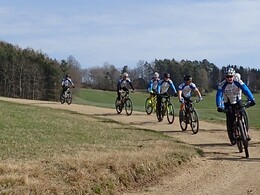
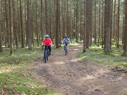
From here, it's straight into the forest, a short gravel descent and you reach Mitterreith. The route continues through forests and meadows to Guttenbrunn without any significant elevation gain. With a bit of luck, you can watch daredevil parachutists landing directly alongside the Freistadt airfield. About 200m away, two culinary stops await the pleasure cyclist: the Gasthaus Dunzinger invites you to linger and there is a small farm store with regional delicacies for on the way or at home.The route continues on great paths with gentle ups and downs to Schöndorf before a short, crisp climb on the goods road to Freudenthal. From here, you ride through beautiful forests to the northernmost point of the tour, the village of Summerau, which you leave on a goods road to Labach.
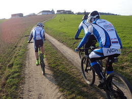
A gravel path between fields leads to St. Peter, a small village situated above Freistadt that offers a small farm store run by the Sollberger family and a magnificent view of Freistadt and its historic old town. The following meters make the mountain biker's heart beat faster, a great descent on a single trail down to the railroad line and then a ride south on the horse-drawn railway path. Crossing the Böhmerwald main road, you ride under the Kronbach bridge of the horse-drawn railway line, a viaduct from times gone by. From now on you have to grit your teeth again, the last ascent is a tough one, 100 steep meters of altitude again off the asphalt bring you back to the starting point in Waldburg.
Around 53% of the route is on natural trails, while the remaining 47% is on paved paths and asphalt (6%).
Nature is always there for us. So it is only fair that we are there for nature too.
Please observe the fair play rules for mountain biking!
Path number: 118
Starting place: 4240 Waldburg
Destination: 4240 Waldburg
duration: 1h 55m
length: 24,5 km
Altitude difference (uphill): 399m
Altitude difference (downhill): 397m
Lowest point: 575m
Highest point: 732m
difficulty: medium
condition: easy
panoramic view: Individual Views
Paths covering:
Asphalt, Path / trail, Gravel, Other
Starting point: Waldburg sports field
Destination: Waldburg sports field
Most economical season
- Spring
- Autumn
Please get in touch for more information.
Waldburg 8a
4240 Waldburg
Phone +43 7942 8300 - 0
E-Mail gemeinde@waldburg.ooe.gv.at
Web www.waldburg.at/
Web www.muehlviertel-urlaub.at/bike
https://www.waldburg.at/
https://www.muehlviertel-urlaub.at/bike
https://www.muehlviertel-urlaub.at/bike
powered by TOURDATA


