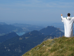
Rundweg zum Nachdenken und Genießen
Path number: 30
Starting place: 5340 St. Gilgen
Destination: 5340 St. Gilgen
information: Akutmeldung/Information
Discover the many places of faith around the Schafberg summit.
Caution - the circular route around the Schafberg is alpine terrain. Appropriate equipment, surefootedness and a head for heights are essential. Children should have mountain experience.At the Schafbergalm there is a nice resting place at the Zahn-Bildstock (pos. 325). The tour then leads from the Schafbergalm on trail no. 20 to the summit, downhill on the Himmelspfortensteig (trail no. 17 - Seenweg) and via the Purtschellersteig back to the Alm.
The Gaiswinkler-Marterl (Pos. 326) and the Hödlmoser-Marterl (Pos. 338) are located off this route on the path to the Kesselalm and on the Auerriesenweg respectively. In order to get to these shrines, a descent of 130 and 355 metres in altitude respectively is required from the Schafbergalm. It is therefore best to visit the latter on the descent from the Schafberg on one of these paths.
- Suitable for single travelers
- Suitable for friends
- Suitable for couples
- Summer
- Autumn
Please get in touch for more information.
Kirchengasse 6
5310 Mondsee am Mondsee
Phone +43 6232 4166
E-Mail pfarre.mondsee@dioezese-linz.at
Web www.dioezese-linz.at/mondsee
https://www.dioezese-linz.at/mondsee


