

Hiking Trail through the nature reserve "Moosrunde"


- pets allowed
- Suitable for families
- Suitable for kids (all ages)
- Flatly
Interactive elevation profile
Create PDF
Tour-Details
Starting place: 4864 Attersee am Attersee
Destination: 4864 Attersee am Attersee
duration: 1h 1m
length: 3,8 km
Altitude difference (uphill): 56m
Altitude difference (downhill): 60m
Lowest point: 476m
Highest point: 536m
difficulty: medium
condition: medium
panoramic view: Some Views
Paths covering:
Street, Hiking trail, Other
powered by TOURDATA
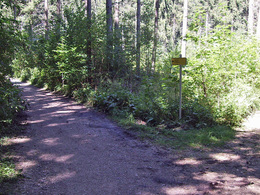
Hike through the beautiful nature reserve in Attersee am Attersee.
You start at the Attersee Train Station. Follow the railway line to Palmsdorf - on the way you pass the Bee farm "Bienenhof Attersee". In Palmsdorf you will pass the taverne Mostschenke "Zum Hoangarten". After refreshments we go through the Reinthaller Moos back to Attersee.
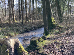
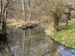
The Reinthaller Moos is a tufa and fen which was declared in a nature reserve in 1990. Here are many rare and endangered plants, especially you will find numerous orchids.
REFRESHMENT STOP:
Mostschenke zum Hoangarten
You start at the Attersee Train Station. Follow the railway line to Palmsdorf - on the way you pass the Bee farm "Bienenhof Attersee". In Palmsdorf you will pass the taverne Mostschenke "Zum Hoangarten". After refreshments we go through the Reinthaller Moos back to Attersee.
The Reinthaller Moos is a tufa and fen which was declared in a nature reserve in 1990. Here are many rare and endangered plants, especially you will find numerous orchids.
REFRESHMENT STOP:
Mostschenke zum Hoangarten
Starting point: Train Station in Attersee am Attersee
Destination: Train Station in Attersee am Attersee
further information:
- Flatly
- Board possible
")
")
Accessibility / arrival
By car:
From Salzburg take the motorway A1 – exit St. Georgen im Attergau – left sight Attersee
From Vienna/Linz take motorway A1 – exit St. Georgen im Attergau – left sight Attersee
From Westside – Bad Ischl – Weißenbachtal – Unterach – Nußdorf – Attersee
By train:
From Salzburg or Vienna/Linz to Vöcklamarkt, change the ÖBB-train to Attergaubahn to Attersee
By plane:
From Salzburg take the motorway A1 – exit St. Georgen im Attergau – left sight Attersee
From Vienna/Linz take the motorway A1 – exit St. Georgen im Attergau – left sight Attersee
- Parking space: 8
Depending on the season, paid parking.
- Suitable for groups
- Suitable for schools
- Suitable for kids (all ages)
- Pets allowed
- Suitable for teenagers
- Suitable for seniors
- Suitable for single travelers
- Suitable for friends
- Suitable for couples
- Suitable for children
- Spring
- Summer
- Autumn
- Early winter
Please get in touch for more information.
")
Attergaustraße 55
4880 St. Georgen im Attergau
Phone +43 7666 7719
E-Mail info@attersee.at
Web attersee-attergau.salzkammergut.at
https://attersee-attergau.salzkammergut.at
You can also visit us on
Visit us on Facebook Visit us on Instagram Visit us on Pinterest Visit our videochannel on YouTube Wikipedia")
")
Interactive elevation profile
Create PDF
Tour-Details
Starting place: 4864 Attersee am Attersee
Destination: 4864 Attersee am Attersee
duration: 1h 1m
length: 3,8 km
Altitude difference (uphill): 56m
Altitude difference (downhill): 60m
Lowest point: 476m
Highest point: 536m
difficulty: medium
condition: medium
panoramic view: Some Views
Paths covering:
Street, Hiking trail, Other
powered by TOURDATA