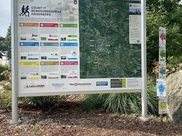
HG BIKE&RACE - COUNT IT movement arena Hagenberg
Path number: H3
Starting place: 4232 Hagenberg im Mühlkreis
Destination: 4232 Hagenberg im Mühlkreis
Kirchenplatz 5a
4232 Hagenberg im Mühlkreis
4232 Hagenberg im Mühlkreis

H3 HG Bike & Race round: Discover the Aisttal - from the Wintermühle to the Kumpfmühle.
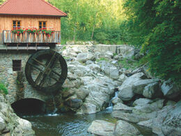
The route leads from the castle park down to the Visnitz. Pass the ponds and continue through the Veichterwald forest to Mahrersdorf and downhill to the Wintermühle mill. There, the route leaves the road and takes you onto a trail that leads along the Aist river over roots and small bridges to the Kumpfmühle mill. From there, you reach the town centre and return to the starting point.Start: Schlosspark
Path number: H3
Starting place: 4232 Hagenberg im Mühlkreis
Destination: 4232 Hagenberg im Mühlkreis
duration: 1h 15m
length: 9,4 km
Altitude difference (uphill): 155m
Altitude difference (downhill): 152m
Lowest point: 425m
Highest point: 488m
difficulty: difficult
condition: difficult
panoramic view: Great panorama
Paths covering:
Asphalt, Gravel, Hiking trail
Starting point: Hagenberg Castle Park
Destination: Hagenberg Castle Park
further information:
- Flatly
- Possible accommodation
Accessibility / arrival
Coming from Linz:
Follow the A7 motorway in the direction of Freistadt until the Unterweitersdorf exit. Follow the Königswiesener Str./B124 to Hagenberg.
- Free entry
- All weather
- Suitable for groups
- Suitable for single travelers
- Suitable for families
- Suitable for friends
- Suitable for couples
- Spring
- Summer
- Autumn
- Early winter
Please get in touch for more information.
Kirchenplatz 5a
4232 Hagenberg im Mühlkreis
Phone +43 7236 2318
E-Mail gemeinde@hagenberg.ooe.gv.at
Web www.hagenberg.at/bewegungsarena
https://www.hagenberg.at/bewegungsarena


