BLUE ZONE round - COUNT IT movement arena Hagenberg
Path number: H4
Starting place: 4232 Hagenberg im Mühlkreis
Destination: 4232 Hagenberg im Mühlkreis
Kirchenplatz 5a
4232 Hagenberg im Mühlkreis
4232 Hagenberg im Mühlkreis

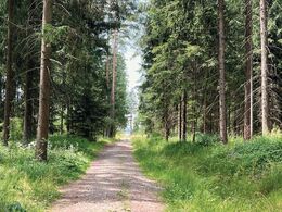
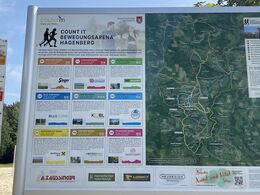
H4 Blue-Zone circuit: compact fitness circuit in the Veichterwald forest.
The route runs from the Park Hotel Hagenberg through residential areas to the Veichterwald forest. There it leaves the tarmac road and runs alongside the forest for a while. Once back on the road, there are a few metres of elevation gain to overcome before passing new housing estates on the way back to the starting point.Start: Park Hotel
Path number: H4
Starting place: 4232 Hagenberg im Mühlkreis
Destination: 4232 Hagenberg im Mühlkreis
duration: 0h 30m
length: 3,7 km
Altitude difference (uphill): 46m
Altitude difference (downhill): 45m
Lowest point: 445m
Highest point: 482m
difficulty: easy
condition: easy
panoramic view: Great panorama
Paths covering:
Asphalt, Gravel, Hiking trail
Starting point: Parkhotel Hagenberg Main street 103
Destination: Parkhotel Hagenberg Main street 103
further information:
- Flatly
- Possible accommodation
- Experience of nature
Accessibility / arrival
Coming from Linz:
Follow the A7 motorway in the direction of Freistadt until the Unterweitersdorf exit. Follow the Königswiesener Str./B124 to Hagenberg.
- Free entry
- All weather
- Suitable for groups
- Suitable for single travelers
- Suitable for families
- Suitable for friends
- Suitable for couples
- Spring
- Summer
- Autumn
- Early winter
Please get in touch for more information.
Kirchenplatz 5a
4232 Hagenberg im Mühlkreis
Phone +43 7236 2318
E-Mail gemeinde@hagenberg.ooe.gv.at
Web www.hagenberg.at/bewegungsarena
https://www.hagenberg.at/bewegungsarena


