G3 STADTRUNDE sponsored by Tischlerei & Wohnstudio Fürst
Path number: G3
Starting place: 4210 Gallneukirchen
Destination: 4210 Gallneukirchen
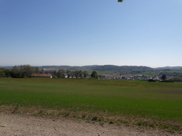
Discover the city's most beautiful recreational areas on foot. This route takes you along the Große Gusen, up to Tumbach, over a section of the horse-drawn railway path, up to the old "Gugaläa" place of execution, to Riedegg Castle in Alberndorf and back again, giving you wonderful impressions of Gallneukirchen. Two short, steep climbs make this route a challenge for beginners as well as experienced runners.
- Distance: 8.9 km
- Duration: 1:25 h
- Ascent: 125 hm
- Descent: 125 metres
- Highest point: 438 metres
- Lowest point: 325 hm
- Surface: approx. half asphalt and half field/forest paths
On four signposted routes with a total length of 35 kilometres, there are signposted running and walking circuits available to athletes. The routes start at the leisure centre near the Calisthenics facility (Veitsdorfer Weg) and extend to Alberndorf, Altenberg and Engerwitzdorf. The signposting is supplemented with information on the elevation profile, surface and level of difficulty. The running laps offer both beginners and "professional athletes" ideal, varied training laps.
The four running and walking routes are also available in the two apps bergfex and Outdooracitve. Both apps can be downloaded free of charge from the Play Store or Apple Store!
Path number: G3
Starting place: 4210 Gallneukirchen
Destination: 4210 Gallneukirchen
duration: 2h 27m
length: 8,9 km
Altitude difference (uphill): 139m
Altitude difference (downhill): 144m
Lowest point: 329m
Highest point: 448m
difficulty: very easy
condition: very easy
panoramic view: No view
Paths covering:
Asphalt, Other
Starting point: Sparkasse Bewegungsarena Gallneukirchen - outdoor pool
Destination: Sparkasse Bewegungsarena Gallneukirchen - outdoor pool
Most economical season
- Spring
- Summer
- Autumn
- Early winter
Suitable for wheelchairs: Not all of the legally stipulated ÖNORM are complied with. In principle, this object is suitable for wheelchairs and no assistance is necessary.
Reichenauer Straße 1
4210 Gallneukirchen
Phone +43 7235 63155
E-Mail stadtgemeinde@gallneukirchen.ooe.gv.at
Web www.gallneukirchen.at/STADT_er_lebe…
https://www.gallneukirchen.at/STADT_er_leben/Tourismus_Freizeit/Laufen_Walken


