© Photo: Oberösterreich Tourismus GmbH./Robert Maybach: Enjoy the view in Upper Austria


A6 Rundweg Weikersdorf - Steinbach


- Flatly
- Possible accommodation
Interactive elevation profile
Create PDF
Tour-Details
Path number: A6
Starting place: 4211 Alberndorf in der Riedmark
Destination: 4211 Alberndorf in der Riedmark
duration: 1h 28m
length: 5,1 km
Altitude difference (uphill): 102m
Altitude difference (downhill): 96m
Lowest point: 587m
Highest point: 664m
difficulty: very easy
condition: very easy
panoramic view: Some Views
Paths covering:
Street, Hiking trail
powered by TOURDATA
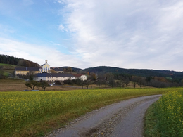
Circular route from Weikersdorf via Kottingersdorf and Steinbach
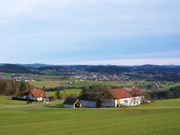
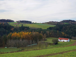
The route continues steeply uphill, past the "Moar" farmhouse. The fresh forest air provides a pleasant respite. Finally, you hike the last section of the circular trail via a field path back to Weikersdorf.
The A4, A5 and A6 hiking trails can be combined to form a longer loop as far as Alberndorf.
Starting point: Weikersdorf
Destination: Weikersdorf
further information:
- Flatly
- Possible accommodation
- Board possible
Accessibility / arrival
How to get there by car:
From Linz, take the A7 motorway to the "Gallneukirchen" exit
Take the Gusental-Bundesstraße towards Schloss Riedegg/Reichenau
Turn left in Klamleiten
Keep right at the fork and follow the road for approx. 2km
Most economical season
- Spring
- Summer
- Autumn
- Early winter
Please get in touch for more information.
4211 Alberndorf in der Riedmark
Phone +43 7235 7155
E-Mail tourismusverband@alberndorf.ooe.gv.at
Web www.alberndorf.at/
https://www.alberndorf.at/
")
")
")
Interactive elevation profile
Create PDF
Tour-Details
Path number: A6
Starting place: 4211 Alberndorf in der Riedmark
Destination: 4211 Alberndorf in der Riedmark
duration: 1h 28m
length: 5,1 km
Altitude difference (uphill): 102m
Altitude difference (downhill): 96m
Lowest point: 587m
Highest point: 664m
difficulty: very easy
condition: very easy
panoramic view: Some Views
Paths covering:
Street, Hiking trail
powered by TOURDATA