© Photo: Oberösterreich Tourismus GmbH./Robert Maybach: Enjoy the view in Upper Austria


A4 zum Wirt in Steinbach


Interactive elevation profile
Create PDF
Tour-Details
Path number: A4
Starting place: 4211 Alberndorf in der Riedmark
Destination: 4211 Alberndorf in der Riedmark
duration: 1h 31m
length: 5,3 km
Altitude difference (uphill): 118m
Altitude difference (downhill): 98m
Lowest point: 479m
Highest point: 601m
difficulty: very easy
condition: very easy
panoramic view: Some Views
Paths covering:
Street, Hiking trail
powered by TOURDATA
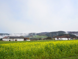
from Alberndorf via Klamleiten to the inn in Steinbach
Shortly afterwards, a dirt track leads to the municipal road into the Gusen valley. The water of the Gusen is spanned by a romantic bridge and then you walk uphill to the "Großer Würschenbauer". A chapel and a bench invite you to enjoy the charming Mühlviertel landscape.
Meadows and forests alternate along the way, and after about half an hour's walk you will see the first farmhouses in the village of Steinbach. You can soon fortify yourself for the return journey with a good snack at the inn in Steinbach.
Alternatively, you can return via hiking trail A6 to Weikersdorf and from there via trail A5 to Alberndorf.
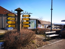
Starting point: Thrift store in the town centre
Destination: Gasthaus Penkner - Inn in Steinbach
further information:
- Board possible
")
")
Accessibility / arrival
How to get there by car:
From Linz, take the A7 motorway to the "Gallneukirchen" exit
Follow the road through Gallneukirchen
After the one-way street, turn diagonally left towards "Alberndorf"
Follow the road for approx. 7 km
The start of the hiking trail is directly in front of the Spar supermarket
There is plenty of free parking just a few metres away behind the municipal office. Turn left after the Spar supermarket onto Kalchgruberstraße, then turn right.
Travelling by bus:
From Linz via Gallneukirchen (you may need to change buses) to "Alberndorf/Rdm. Ortsmitte"
The bus stop is just a few metres from the Spar supermarket.
Parking- Parking space: 30
- Parking area for disabled: 2
- Charging point for electric cars (fees apply)
- Charging point for e-bikes (free of charge)
Most economical season
- Spring
- Summer
- Autumn
- Early winter
Please get in touch for more information.
4211 Alberndorf in der Riedmark
Phone +43 7235 7155
E-Mail tourismusverband@alberndorf.ooe.gv.at
Web www.alberndorf.at/
https://www.alberndorf.at/
")
")
Interactive elevation profile
Create PDF
Tour-Details
Path number: A4
Starting place: 4211 Alberndorf in der Riedmark
Destination: 4211 Alberndorf in der Riedmark
duration: 1h 31m
length: 5,3 km
Altitude difference (uphill): 118m
Altitude difference (downhill): 98m
Lowest point: 479m
Highest point: 601m
difficulty: very easy
condition: very easy
panoramic view: Some Views
Paths covering:
Street, Hiking trail
powered by TOURDATA