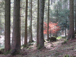
Orte des Glaubens: Von der Ebnater Aussicht ins dunkle Vöcklatal
Path number: 7
Starting place: 5310 Tiefgraben am Mondsee
Destination: 5310 Tiefgraben am Mondsee
This tour leads partly along the popular Tannenweg trail.
From the car park, continue along the road towards Haslau to the junction for Ebnat. We follow this road uphill to its end, where the marked hiking trail (Tannenweg) continues through the forest into the Vöcklatal valley. The Hussen "Marterl" (item 87) is a little off the forest path in the direction of Sulzberg. Once we reach Haslaustraße, we turn left to the Hascherl-Marterl (item 90) and from there follow the road back to the car park. Path number: 7
Starting place: 5310 Tiefgraben am Mondsee
Destination: 5310 Tiefgraben am Mondsee
duration: 2h 47m
length: 9,6 km
Altitude difference (uphill): 225m
Altitude difference (downhill): 221m
Lowest point: 707m
Highest point: 860m
difficulty: medium
condition: medium
panoramic view: Individual Views
Paths covering:
Asphalt, Hiking trail
further information:
- Flatly
Details - hiking
- themed path
Parking
- Parking space: 5
- All weather
- Suitable for groups
- Suitable for schools
- Pets allowed
- Suitable for teenagers
- Suitable for seniors
- Suitable for single travelers
- Suitable for families
- Suitable for friends
- Suitable for couples
- Spring
- Summer
- Autumn
- Early winter
Please get in touch for more information.
Kirchengasse 1
5310 Mondsee am Mondsee
Phone +43 6232 4166
E-Mail pfarre.mondsee@dioezese-linz.at
Web www.dioezese-linz.at/mondsee
https://www.dioezese-linz.at/mondsee
powered by TOURDATA


