© Photo: Oberösterreich Tourismus GmbH./Robert Maybach: Enjoy the view in Upper Austria
Enjoy the view in Upper Austria
Search
Search
Close

Wildererweg Pyhrn-Priel - History

  • pets allowed
  • Suitable for families

 Interactive elevation profile

Download GPS data
Create PDF

Tour-Details

Starting place: 4575 Roßleithen
Destination: 4575 Roßleithen

duration: 2h 30m
length: 12,0 km
Altitude difference (uphill): 818m
Altitude difference (downhill): 77m

Lowest point: 669m
Highest point: 1.417m
difficulty: medium
condition: difficult
panoramic view: Great panorama

Paths covering:
Gravel, Hiking trail

powered by TOURDATA

information: Akutmeldung/Information
Poachers' Trail History - the Wildschütz Johann Farnberger Steig is a journey through time to the Mayralm crime scene for those who enjoy nature and history


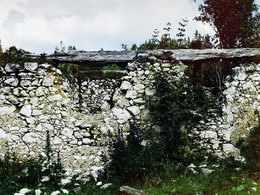
In the Salzatal valley, turn left to the Leithersteig trail. The path begins steeply and winds its way uphill. After a clearing, follow the path through the coniferous forest. After a small forest plateau, you walk along a narrow, steep path until you reach the flat Bloßboden. The path continues to the left over a slope, through a flat, wildly overgrown section of forest to a flat clearing. At the beginning of the forest opposite, you continue along a stony forest path that leads you straight ahead through the sparse forest before it climbs steeply after a slight left-hand bend and suddenly a huge high plateau opens up - the Mayralm. It resembles an arena, in the centre of which the dilapidated Mayralm lies like an unreal ruin right in front of you. Across the alpine meadow up to the ridge, directly in line with the Mayralm, you will find the Hunter's Cross or Hunter's Stone on the right-hand side at the edge of the forest. This bears witness to the fierce battles that took place on the Mayralm and is perhaps the reason for the mysterious atmosphere.

BACKGROUND HISTORY DETAILS

Starting point: diversion Salzatal
Destination: diversion Salzatal

Details - hiking
  • themed path
Accessibility / arrival

A9 motorway exit Rossleithen. After the warehouse, turn left towards Windischgarsten Nord, then follow the road until you reach a bottleneck - here you turn left towards Villa Sonnwend. After a few hundred metres, the path starts to the left towards Patzlberg.

Travelling by public transport
Route planner for independent travellers
  • Suitable for groups
  • Pets allowed
  • Suitable for teenagers
  • Suitable for single travelers
  • Suitable for friends
  • Suitable for couples
Most economical season
  • Spring
  • Summer
  • Autumn

Please get in touch for more information.


Wildererweg Pyhrn-Priel - History
Pyhrn-Priel Tourismus GmbH
Bahnhofstraße 2
4580 Windischgarsten

Phone +43 7562 5266
E-Mail info@pyhrn-priel.net
Web www.wildererweg.at
http://www.wildererweg.at

We speak the following languages

German

 Interactive elevation profile

Download GPS data
Create PDF

Tour-Details

Starting place: 4575 Roßleithen
Destination: 4575 Roßleithen

duration: 2h 30m
length: 12,0 km
Altitude difference (uphill): 818m
Altitude difference (downhill): 77m

Lowest point: 669m
Highest point: 1.417m
difficulty: medium
condition: difficult
panoramic view: Great panorama

Paths covering:
Gravel, Hiking trail

powered by TOURDATA