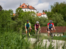
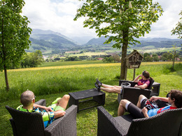
© Photo: Oberösterreich Tourismus GmbH./Robert Maybach: Enjoy the view in Upper Austria
Enjoy the view in Upper Austria
Search
Search
Close

382 Cycle tour "Sportpanorama"

  • culinary interesting
  • culturally interesting
  • Flatly

 Interactive elevation profile

Download GPS data
Create PDF

Tour-Details

Path number: 382
Starting place: 4540 Bad Hall
Destination: 4540 Bad Hall

duration: 4h 0m
length: 53,0 km
Altitude difference (uphill): 750m

difficulty: easy
condition: easy
panoramic view: Great panorama

Paths covering:
Asphalt

powered by TOURDATA

Short loop with a magnificent panorama on varied terrain; corresponds to no. 382 of the Bad Hall cycle routes and is signposted throughout.


After the undulating start via Steinersdorf, the first ascent behind Waldneukirchen is the longest of the tour: it is mostly in the double-digit percentage range with a flat section in between on the Hohe Linde. The marvellous view of the Steyrtal and Sengsengebirge and the subsequent brisk ride through the Haller Wald forest to the pilgrimage site of Adlwang make up for many a drop of sweat. The route continues along a variety of goods roads to Nußbach, where the flat ascent - apart from the first few metres - begins in the district of Göritz to the "tree in the middle of the world", one of the most beautiful panoramic spots in the area with views of the Kremstal, Traunstein and Kremsmauer. The rapid descent to Kremsmünster is followed by flat kilometres through the Au area to Rohr and from there a final terrain step on the eastern side of the Kremstal to roll back via Mengersdorf with great views.

 Interactive elevation profile

Download GPS data
Create PDF

Tour-Details

Path number: 382
Starting place: 4540 Bad Hall
Destination: 4540 Bad Hall

duration: 4h 0m
length: 53,0 km
Altitude difference (uphill): 750m

difficulty: easy
condition: easy
panoramic view: Great panorama

Paths covering:
Asphalt

powered by TOURDATA