© Photo: Oberösterreich Tourismus GmbH/Robert Maybach: Linz in Upper Austria
Linz in Upper Austria
search
Search
Close

St. Agatha: “Es muss sein” (“It has to be”) Trail

St. Agatha: “Es muss sein” (“It has to be”) Trail
Ein Produkt der hubermedia GmbH
  • Flatly

 Interactive elevation profile

Download GPS data
Create PDF

Tour-Details

Starting place: 4084 St. Agatha
Destination: 4084 St. Agatha

duration: 7h 30m
length: 20,7 km
Altitude difference (uphill): 619m
Altitude difference (downhill): 618m

Lowest point: 283m
Highest point: 632m
difficulty: medium
condition: medium
panoramic view: Dreamtour

Paths covering:
Asphalt, Path / trail, Gravel, Other

powered by TOURDATA

Short description:
Hiking trail offering fantastic views of the Mühlviertel district, the foothills of the Alps and the Schlögen Danube Loop.
Quality of experience: *****

Recommended season:
  • March
  • April
  • May
  • June
  • July
  • August
  • September
  • October
  • November
Properties:
  • Loop
  • Scenic
  • Refreshment stops available
  • Geological highlights

Description:
From Kirchenplatz square we hike along Hauptstraße and take a right turn into Schulweg road. We hike past the secondary school and continue on a country lane. We hike northwards and get to Etzing, where there is also a Donausteig resting place. After Etzing we take a right turn and hike down towards the Danube. We leave the road at the last farm house and continue on a country lane and ...
Starting point: St. Agatha
Destination: Ortszentrum St. Agatha

further information:
  • Flatly
  • Board possible

Accessibility / arrival

Getting there
By car:
... from Passau: take “Passau-Nord” or “Passau-Mitte” autobahn exit, toll free on Nibelungenstraße, B130 (approx. 40km);
... from Linz: toll free on the B129 past Eferding (B130);
... from Wels: toll free on the B137 or B134 past Eferding (B130);
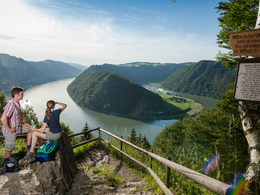
St. Agatha is located at the southern bank of the Danube.

By train:
... past Passau - Neumarkt - Grieskirchen - Linz;
The nearest train station is in Waizenkirchen (7km).
www.oebb.at

By boat:
... on the Danube: from Passau - Schlögen or Linz - Schlögen (Wurm + Köck shipping company)
www.donauschiffahrt.de

Public Transit
Bus: www.postbus.atParking
Municipality of St. Agatha
Travelling by public transport
Route planner for independent travellers
Most economical season
  • Spring
  • Summer
  • Autumn
  • Early winter

Please get in touch for more information.


St. Agatha: “Es muss sein” (“It has to be”) Trail
Gemeinde Sankt Agatha
Kirchenplatz 1
4083 St. Agatha

Phone +43 7277 8255 - 0
E-Mail info.st-agatha@oberoesterreich.at
Web tourismus.st-agatha.at
Web www.st-agatha.at
https://tourismus.st-agatha.at
http://www.st-agatha.at

We speak the following languages

German

 Interactive elevation profile

Download GPS data
Create PDF

Tour-Details

Starting place: 4084 St. Agatha
Destination: 4084 St. Agatha

duration: 7h 30m
length: 20,7 km
Altitude difference (uphill): 619m
Altitude difference (downhill): 618m

Lowest point: 283m
Highest point: 632m
difficulty: medium
condition: medium
panoramic view: Dreamtour

Paths covering:
Asphalt, Path / trail, Gravel, Other

powered by TOURDATA
Protected by