© Foto Oberösterreich Tourismus GmbH/Robert Maybach: Die Weiten des Mühlviertels genießen.


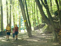
Bachwanderweg Oed (P2)


Interactive elevation profile
Create PDF
Tour-Details
Starting place: 5166 Perwang am Grabensee
Destination: 5221 Lochen
duration: 1h 35m
length: 6,0 km
Altitude difference (uphill): 77m
Altitude difference (downhill): 46m
Lowest point: 505m
Highest point: 555m
difficulty: easy
condition: easy
panoramic view: Individual Views
Paths covering:
Hiking trail, Other
powered by TOURDATA
approx. 3 kmFrom Perwang via Mundenham to Rackersing (municipality of Lochen). The hiking trail leads through the wasteland along the Berndorferbach stream with a very interesting meadow landscape, which is of great botanical value.
Most economical season
- Spring
- Summer
- Autumn
Please get in touch for more information.
Theatergasse 3
5280 Braunau am Inn
Phone +43 6217 8731 - 16
E-Mail andreas.oitner@oitner-bau.at
Web www.perwang.at
Web www.entdeckerviertel.at
http://www.perwang.at
http://www.entdeckerviertel.at
http://www.entdeckerviertel.at
Interactive elevation profile
Create PDF
Tour-Details
Starting place: 5166 Perwang am Grabensee
Destination: 5221 Lochen
duration: 1h 35m
length: 6,0 km
Altitude difference (uphill): 77m
Altitude difference (downhill): 46m
Lowest point: 505m
Highest point: 555m
difficulty: easy
condition: easy
panoramic view: Individual Views
Paths covering:
Hiking trail, Other
powered by TOURDATA