R8 Pferdeeisenbahnrundweg
Path number: R8
Starting place: 4261 Rainbach im Mühlkreis
Destination: 4261 Rainbach im Mühlkreis
Prager Straße 5
4261 Rainbach im Mühlkreis
4261 Rainbach im Mühlkreis

information: Detour S10 construction site Rainbach Nord
Description: Due to the construction site of the S10 construction site (asfinag) near Rainbach, the hiking trail has to be rerouted for 2 years. The GPS data - including current detour - are available for download.
Walk in the footsteps of the horse-drawn railway to Kerschbaum. Extension via Unterpaßberg and the Castle and Palace Trail possible.
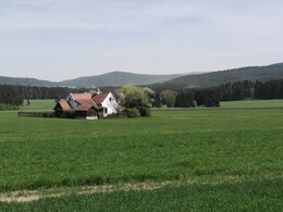
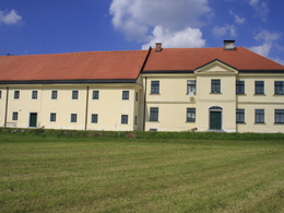
The hike starts past the Rainbach parish church in the direction of Kerschbaum. After about 1.3km you will find the first viaduct of the horse-drawn railway and a small railway guard's cottage. Tip: visit the horse-drawn railway museum in Kerschbaum. Here you can learn interesting facts about the first railway on the European continent. www.pferdeeisenbahn.atYou will also find viaducts in the forest and hike along the route of the horse-drawn railway. Coming out of the forest, you can already see the large yellow railway station building. You can choose between 2 routes back to Rainbach. The shorter one leads through a beautiful wooded area directly to Rainbach.
The longer one takes you to the village of Unterpaßberg, where you cross the Feldaist over the "Passberger Steg" and return to Rainbach.
Path number: R8
Starting place: 4261 Rainbach im Mühlkreis
Destination: 4261 Rainbach im Mühlkreis
duration: 2h 29m
length: 9,6 km
Altitude difference (uphill): 85m
Altitude difference (downhill): 89m
Lowest point: 678m
Highest point: 738m
difficulty: easy
condition: easy
panoramic view: Individual Views
Paths covering:
Hiking trail, Other
Starting point: Rainbach im Mühlkreis town center near the Weinhäusl
Destination: Rainbach im Mühlkreis town center near the Weinhäusl
further information:
Most economical season
- Spring
- Summer
- Autumn
Please get in touch for more information.
Prager Straße 5
4261 Rainbach im Mühlkreis
Phone +43 664 4214734
E-Mail tourismus@rainbach.at
Web www.rainbach.at/
https://www.rainbach.at/


