Energierunde Freistadt
4240 Freistadt

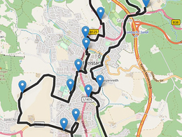
A walking or cycling tour around Freistadt to 14 interesting places related to the use of energy. The tour is signposted at the 14 stations and includes an audio guide at Hearonymus https://direct.hearonymus.com/guide/1240.
Since 1991, the municipality of Freistadt has been a member of the Austrian Climate Alliance, which, as part of a partnership of almost 2,000 municipalities in Europe, has set itself the goal of sustainably reducing greenhouse gas emissions in the urban area and supporting indigenous peoples in South America in preserving the rainforest.
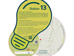
climate-neutral municipality of Freistadt can be viewed and experienced. At each of the 14 stations, visitors receive information about the respective project and its energy-related achievements. The (not yet installed) signs at the stations contain a QR code that provides access to the Hearonymus audio guide . An energy folder shows the course and the stations of the energy tour and encourages people to find out more about the projects and the ambitions of their sponsors.
The individual stations with audio guide:
- Sunflower Brewery
- Charging station and e-car sharing Alter Tennisplatz
- Biomass heating plant Hofer Nord roundabout (wood chips 2.3MW + solar thermal energy, SW demand recording)
- Self-sufficient photovoltaic fire brigade with carpooling bench Rainbach
- Small wind turbine Vierzehn (2.5kWh)
- Second Thuryhammer (hydropower) of the Pro Freistadt association and
- New water reservoir + deacidification above Thurytal (expansion option for kinetic energy)
- LED street lighting Zaglau
- Sun house and Lasbergerstraße carpooling bench
- Wastewater treatment plant of the Reinhaltungsverband with PV system, sewage gas utilisation and wastewater heat
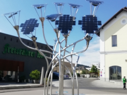
- Façade-integrated photovoltaics Open space
- District waste association Leonfelderstrasse at the ASZ (thermal insulation materials for refurbishment)
- Biogas plant Bioenergie Freistadt Ziegler OG
- Solar thermal energy (on the SV Freistadt football pitch outbuilding)
In the show workshop of the historic Thuryhammer, you can mint your own coin by prior appointment.
mint your own coin.
Tip:
Walking time approx. 4 hours and by bike approx. 2 1/2 hours
Safety instructions
Please wear a helmet on your bike. Please push your bike when cycling on the prohibited sections.
Equipment
Bicycle, smartphone, pen, water bottle, questionnaire, hiking app outdooractive/alpenvereinaktiv, audio guide app Hearonymus, quiz app Geocaching
Adventure.
Paths covering:
further information:
- Flatly
Public transport
Reachable by train and bus. By public bus to Stifterplatz
How to get there
The best way is by car to the Alter Tennisplatz car park (circular tour stop 2, Wanderstein)
Free parking at the Wanderstein, parking at the Freistadt brewery for customers only, BH car park limited parking for a fee
- Spring
- Summer
- Autumn
Please get in touch for more information.
Salzgasse 23
4240 Freistadt
Phone +43 7942 7250640
mobile +43 664 4739598
E-Mail freistadt@sektion.alpenverein.at
Web www.alpenvereinaktiv.com/s/JF9oV


