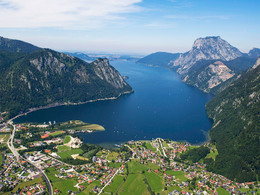
Sagenhaftes Ebensee - Sagenweg 6, um den Traunsee
Starting place: 4802 Ebensee
Destination: 4802 Ebensee
A book by Karin Schmied and Ursula Rohrweck (both from the Ebensee library) entitled "Sagenhaftes Ebensee" will be published in 2022, in which 32 legends from the Traunsee municipality of Ebensee and its immediate surroundings are written down. On the 8 legend trails, you can follow in the footsteps of the legends and their locations on foot or in some cases by bike.
Walk along the B 145 towards Traunkirchen, either on foot or by bike to the "Lion Monument". The section after 1 km is particularly beautiful, where the cars drive through the tunnels and the old main road on the shore of Lake Traunsee is only open to cyclists and pedestrians.
We also recommend a round trip with the Traunsee boat service or hiring an electric boat.
The following legends can be found on this tour:
- the statue of St John
- the Bartl cross
- the Lion Monument
- the Wechselkreuz
- the knight of Karbach
- the giant Erla - view to the Traunstein
- the fearless woodcutter
- the prospector of Karbach
- the Rötelsee lakes
- the tale of the Rötelsee gold
Karin Schmied/Ursula Rohrweck
Legendary Ebensee
32 legends and stories for hikers
Softcover, approx. 150 pages
Format: 13.5 x 21 cm
Euro approx. 20,00
Publication date: November 2022
Legendary journey through Ebensee
Dwarves, witches, giants and other mythical figures populate the legendary world of the Salzkammergut. This book traces the traditional stories surrounding the saltworks town of Ebensee on the southern shore of Lake Traunsee and invites you to discover the locations on marked walks.
The authors have edited the legends in a contemporary style and each legend is accompanied by notes on local history. Authors from Ebensee, including Sarah Michaela Orlovský, have contributed new legends.
The 32 legends are organised into eight legend trails. The routes can be accessed via QR codes and an accompanying map. The world of legends can thus be explored on foot or by bike. All the legends are also available as audio files, which can also be listened to using QR codes. The book also contains five legends in English.
The net proceeds from the book project will go to the Ebensee library.
About the authors:
Karin Schmied
Born in 1957, lives in Ebensee, studied English and History at the University of Salzburg and taught at Gmunden Grammar School until her retirement. Voluntary head of the Ebensee community and parish library since 1998.
Ursula Rohrweck
Born in 1957, grew up in Ebensee, where she also lives. Retired primary school teacher and headmistress. Volunteer librarian at the Ebensee library. She writes texts and reads old writings in the Spinnstube Ebensee.
Most economical season
- Spring
- Summer
- Autumn
Please get in touch for more information.
Hauptstraße 34
4802 Ebensee
Phone +43 6133 8016
E-Mail buecherei@ebensee.ooe.gv.at
Web www.ebensee.com
Web ebensee.bvoe.at
http://www.ebensee.com
http://ebensee.bvoe.at
http://ebensee.bvoe.at


