

Racing bike hill world Mühlviertel - "Mühlviertel 8000 Tour"


- Flatly
- Possible accommodation
Interactive elevation profile
Create PDF
Tour-Details
Path number: Etappe 5 Rennradstrecke 75 km und 1650 hm
Starting place: 4190 Bad Leonfelden
Destination: 4251 Sandl
duration: 4h 0m
length: 74,8 km
Altitude difference (uphill): 1.353m
Altitude difference (downhill): 1.154m
Lowest point: 529m
Highest point: 1.039m
difficulty: very difficult
condition: very difficult
panoramic view: Great panorama
Paths covering:
Asphalt, Street
powered by TOURDATA
information: Road bike route - digitally prepared
Description: The navigation of the road bike route "Mühlviertel 8000 Tour" is only available in digital form. You can easily download the GPS file on this page
In addition, the tour is also presented in our free A3 flyer .
8 mountains. 8 winners. 8 heroes. is the slogan for the extreme event "Mühlviertel 8,000".
In this team competition, a relay team of eight starts over eight of the highest mountains in the Mühlviertel.
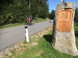
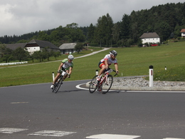
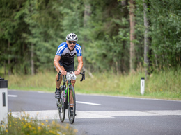
The 5th "racing bike" stage starts in Weigetschlag and covers a distance of approx. 75 km and 1,650 metres in altitude via Freistadt to Liebenau, crossing the Koblberg (1044 m), the highest pass road in Upper Austria. After numerous Mühlviertel-typical hills, the athletes reach the finish in Sandl at the Viehberg ski resort.
Path types:
Cycle path: 2.00 km
Side road: 1.00 km
Road: 48.40 km
Main road: 23.40 km
Road condition:
Road surface: 10.50 km
Asphalt: 64.30 km
Car parking facilities:
Repair facilities:
In this team competition, a relay team of eight starts over eight of the highest mountains in the Mühlviertel.
The 5th "racing bike" stage starts in Weigetschlag and covers a distance of approx. 75 km and 1,650 metres in altitude via Freistadt to Liebenau, crossing the Koblberg (1044 m), the highest pass road in Upper Austria. After numerous Mühlviertel-typical hills, the athletes reach the finish in Sandl at the Viehberg ski resort.
Path types:
Cycle path: 2.00 km
Side road: 1.00 km
Road: 48.40 km
Main road: 23.40 km
Road condition:
Road surface: 10.50 km
Asphalt: 64.30 km
Car parking facilities:
- Weigetschlag near the border to the Czech Republic
- Bad Leonfelden
Repair facilities:
- Intersport Pötscher in Freistadt
- Radsport Fischerlehner in Freistadt
- Rotschne company in Freistadt
- Guesthouse Weitblick in St. Leonhard near Freistadt
 (© FotoGrafik bruno haneder)")
")
")
- Suitable for single travelers
- Suitable for friends
- Spring
- Summer
- Autumn
Please get in touch for more information.
")
Lebensquellplatz 1
4283 Bad Zell
Phone +43 5 07263 - 21
E-Mail anfrage@muehlviertel.at
Web www.rennradhuegelwelt.at
https://www.rennradhuegelwelt.at


")
")
")
Interactive elevation profile
Create PDF
Tour-Details
Path number: Etappe 5 Rennradstrecke 75 km und 1650 hm
Starting place: 4190 Bad Leonfelden
Destination: 4251 Sandl
duration: 4h 0m
length: 74,8 km
Altitude difference (uphill): 1.353m
Altitude difference (downhill): 1.154m
Lowest point: 529m
Highest point: 1.039m
difficulty: very difficult
condition: very difficult
panoramic view: Great panorama
Paths covering:
Asphalt, Street
powered by TOURDATA