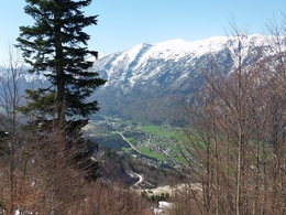
Mountainbikestrecke Ascherstraße
Starting place: 4802 Ebensee
Destination: 4802 Ebensee
Very short mountain bike route to improve your fitness
Due to the extension of the blasting area for the quarry, it is unfortunately not possible to go any further up.
Starting place: 4802 Ebensee
Destination: 4802 Ebensee
duration: 1h 41m
length: 5,5 km
Altitude difference (uphill): 214m
Altitude difference (downhill): 26m
Lowest point: 424m
Highest point: 635m
difficulty: medium
condition: medium
panoramic view: No view
Paths covering:
Path / trail, Gravel
details mountainbike
- Riding technique: medium
15th April - 31st October each year
Most economical season
- Spring
- Summer
- Autumn
Please get in touch for more information.
Hauptstraße 34
4802 Ebensee
Phone +43 6133 8016
Fax machine +43 6133 8016870
E-Mail ebensee@traunsee-almtal.at
Web www.ebensee.com
Web traunsee-almtal.salzkammergut.at/be…
http://www.ebensee.com
https://traunsee-almtal.salzkammergut.at/bewegung-in-der-natur/radfahren-mountainbike-e-bike/mountainbikerouten.html
https://traunsee-almtal.salzkammergut.at/bewegung-in-der-natur/radfahren-mountainbike-e-bike/mountainbikerouten.html


