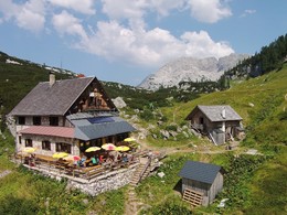
Vom Almsee über Grieskarsteig zur Pühringer Hütte
The tour leads from the Almsee lake in Grünau im Almtal via the Grieskarsteig trail to the Pühringerhütte hut in the Totes Gebirge mountains
Starting from the Seehaus, hike southwards on a forest road slightly uphill through the forest to the "Röll", an impressive rocky basin. Back in the forest, you come to a fork in the Sepp-Huber-Steig/Grießkarsteig trail. The Griekarsteig branches off to the right here. The Grieskarsteig leads up through mountain pine bushes and rocky terrain, with steep sections secured with wire ropes. The last section up the "Ernst-Urban-Band" is negotiated with the help of an iron ladder and a long wire rope, finally leading across a snow field and then steeply up to the saddle. From the Grieskarscharte, the route leads over the Abblassbühel and the Elmgrube to the Pühringerhütte.
From the Aknsee lake, plan approx. 6 hours.
Paths covering:
further information:
- Possible accommodation
- Board possible
Details - climbing mount
How to get to the mountaineering village of Grünau im Almtal:
We recommend travelling by public transport!
by train: from Wels railway station with the Almtalbahn (line 153) to Grünau im Almtal;
numerous connections from Wels railway station to the main trains on the Westbahn line (line 101)
by bus: OÖVV bus line 533/534 Almsee - Grünau im Almtal - Gmunden
Bus-Bahn information
with the Salzkammergut Shuttle Service Route 60 from Grünau station to the Almsee GH Seehaus stop, call the taxi centre at least 1 hour in advance on telephone number 050-422 422 and order.
On foot: From the centre or Grünau im Almtal train station, you can comfortably hike the Almuferweg "Genuss am Almfluss" via Cumberland Wildpark to the Almsee!
By car:
West motorway A1: Vienna - Voralpenkreuz-A9 - exit Ried/Tr. - Voitsdorf - Pettenbach - Scharnstein - Grünau
West motorway A1: Munich - Salzburg - Regau - Gmunden - Scharnstein - Grünau
Inntal motorway A8 Passau - Wels - Voralpenkreuz A9 - exit Ried/Tr. - Voitsdorf - Pettenbach - Scharnstein - Grünau
From the centre of Grünau follow the country road to the Almsee (15km).
Parking facilities with alpine clock
The nearest airports are Linz-Hörsching, 55 km and Salzburg, 80 km
- Parking space: 10
- Summer
Please get in touch for more information.
Im Dorf 17
4645 Grünau im Almtal
Phone +43 7616 8268
E-Mail almtal@traunsee-almtal.at
Web traunsee-almtal.salzkammergut.at/
Web www.puehringerhuette.at/
http://www.puehringerhuette.at/


