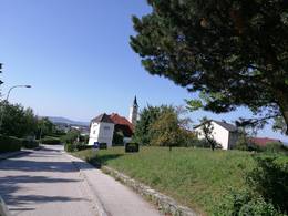
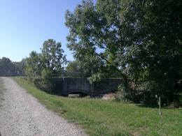
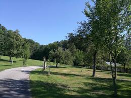
© Photo: Oberösterreich Tourismus GmbH./Robert Maybach: Enjoy the view in Upper Austria
Enjoy the view in Upper Austria
Search
Search
Close

Genusstour in Ansfelden

  • pets allowed
  • All weather
  • Suitable for families
  • culinary interesting
  • culturally interesting
  • Flatly
  • Possible accommodation

 Interactive elevation profile

Download GPS data
Create PDF

Tour-Details

Starting place: 4052 Ansfelden
Destination: 4052 Ansfelden

duration: 3h 27m
length: 13,5 km
Altitude difference (uphill): 101m
Altitude difference (downhill): 104m

Lowest point: 260m
Highest point: 360m
difficulty: easy
condition: easy
panoramic view: Some Views

Paths covering:
Asphalt, Path / trail, Hiking trail, Other

powered by TOURDATA

Pleasure tour through the most beautiful parts of Ansfelden!

Start at the car park at Hotel Stockinger.

Turn left towards Petersberger (first steep hurdle to overcome here).

The route finally runs along the path through the forest, on through Fürhappen, back down towards Ansfeldner Kirche, to the first refreshment stop at Gasthof Grillenberger.

Turn right again and continue to EREMA, under the motorway to the 2nd refreshment station at Freindorfer Hof.

Cross the motorway along the Traunuferstraße road to the 3rd refreshment station at Gasthof Strauß.

A few hundred metres and right to Audorf to the 4th stop at Cafe Pension Brandl.

Here you finally return to the Au.

The final sprint to the finish at Hotel Stockinger runs along the Auweg.

Parking
  • Parking space: 100
  • Bus parking space: 3
Travelling by public transport
Route planner for independent travellers
  • All weather
  • Suitable for groups
  • Suitable for schools
  • Pets allowed
  • Suitable for teenagers
  • Suitable for seniors
  • Suitable for single travelers
  • Suitable for friends
  • Suitable for couples
  • Suitable for children
Most economical season
  • Spring
  • Summer
  • Autumn

Please get in touch for more information.

other information
  • Toilet facility for disabled people

Genusstour in Ansfelden
Ansfelden Über Nacht
Ritzlhofstraße 65-68
4053 Ansfelden

E-Mail gasthof@tanz-strauss.at
Web www.hotel-ansfelden.at
Web www.ansfelden.jetzt
http://www.hotel-ansfelden.at
http://www.ansfelden.jetzt

You can also visit us on

Visit us on Facebook

We speak the following languages

German

 Interactive elevation profile

Download GPS data
Create PDF

Tour-Details

Starting place: 4052 Ansfelden
Destination: 4052 Ansfelden

duration: 3h 27m
length: 13,5 km
Altitude difference (uphill): 101m
Altitude difference (downhill): 104m

Lowest point: 260m
Highest point: 360m
difficulty: easy
condition: easy
panoramic view: Some Views

Paths covering:
Asphalt, Path / trail, Hiking trail, Other

powered by TOURDATA