Die Hopfenkönig Tour - Traunsee-Almtal Wanderspass
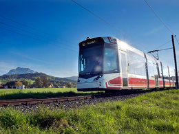
A hike with the Traunseetram
On the "Mayrhof-Runde" along the Laudach past the golf course to the centre of Kirchham (50 min.). Please note that this is a hiking trail and cycling is not permitted everywhere!
Refreshments available at Gasthaus Pöll. Hiking stamps available here.
At GH Bauer, turn right - into the village of "In der Au" - along the Laudach-
Auen, past the fitness park and then turn right over the wooden Laudach bridge into the village of "Kumpfmühle". From there in the direction of Vorchdorf - take the first right towards "Eich-
ham". In "Eichham" at the crossroads (house "Sadleder") turn left towards Eggenberg - as far as Gasthaus Hinterreitner - from there turn right into the Eggenberg brewery (approx. 300 m).
Possibility of a guided tour of the brewery. From the Schloss Eggenberg brewery it is a 30-minute walk to the centre of Vorchdorf.
The entire hike can always be coordinated with the TraunseeTram.
How to get to Gmunden am Traunsee: (Engelhof train station)
We recommend travelling by public transport!
By train: from Attnang-Puchheim station with the Salzkammergutbahn (line 170) to Gmunden; numerous connections from Attnang-Puchheim station to the main trains on the Westbahn line (line 101)
The Traunsee Tram takes you directly from Gmunden station to Engelhof station. It is also possible to take the Traunsee Tram from Vorchdorf to Engelhof station.
by bus: OÖVV bus routes 533 Gmunden - Grünau im Almtal - Almsee
Stop Engelhof B 120 - this stop is only 400 metres from Engelhof train station
by micro public transport - Salzkammergut Shuttle Service:
with routes 20, 21, 90 and 95 of the Salzkammergut Shuttle Service to Gmunden train station, at least 1 hour in advance. 1 hour in advance by calling the telephone number +43 50-422 422 at the taxi centre and ordering.
Continue with the Traunsee tram to Engelhof station
by bike: cycle paths R 2 Salzkammergut cycle path and R 4 Traun cycle path as well as the Traunvierteltour to Gmunden. The Engelhof train station is only 500 metres away from the Traunvierteltour.
On foot: From the centre (Gmunden Rathausplatz) you can also take a leisurely walk along the railway road to the Engelhof train station!
By car:
West motorway A1: From Vienna/Linz or Salzburg/Munich. Salzburg/Munich to the Regau exit - take the B 145 Salzkammergut Bundesstraße towards Gmunden - before Gmunden turn left onto the B 120 bypass towards Gmunden Ost - at the first roundabout take the first exit into the left lane, at the second roundabout take the second exit towards Scharnstein/Kirchdorf - at the next roundabout take the first exit through the village of Baumgarten to Gmunden, at GH Engelhof turn left into Laudachseestraße - after 500 metres Engelhof railway station is on the left.
From Scharnstein/Kirchdorf on the B 120 to the roundabout - third exit and through the village of Baumgarten to Gmunden, at GH Engelhof turn left into Laudachseestraße - after 500 metres Engelhof railway station is on the left.
- Parking space: 50
- Bus parking space: 2
- All weather
- Suitable for groups
- Suitable for kids (5 - 14 Year)
- Suitable for teenagers
- Suitable for seniors
- Suitable for single travelers
- Suitable for families
- Suitable for friends
- Suitable for couples
- Spring
- Summer
- Autumn
Please get in touch for more information.
Toscanapark 1
4810 Gmunden
Phone +43 7612 74451
Fax machine +43 7612 71410
E-Mail info@traunsee-almtal.at
Web www.traunsee-almtal.at
Web www.wander-spass.at
http://www.wander-spass.at


