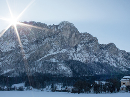
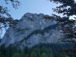
Under mount Drachenwand
Starting place: 5310 St. Lorenz am Mondsee
Destination: 5310 St. Lorenz am Mondsee

Small circular route through the forest at the foot of the Drachenwand and Schober.
The starting point is the parking lot for via ferrata climbers near the Drachenwand inn. Immediately after the Gasthof Drachenwand, we turn right onto a steep path that leads us directly into the forest (signposts for Almkogel and Drachenwand).
After about 200m we reach the junction in the direction of Schober and Wartenfels ruins and follow this straight ahead on a comfortable forest path. Now we hike past a beautiful Materl and some streams and finally the hike ends in a forest road. There we turn left and immediately right again, following the signs to Schober. After a gentle uphill section, the hiking trail branches off to the left in the direction of Schober.
This path leads us through a water and spring reserve. The overflow from which the fresh spring water gushes out can be heard from afar. We follow the hiking trail to a clearing with a great view of Mondsee. There the hiking trail joins another forest road. Now, however, no longer follow the signs to Schober, but keep walking gently downhill on the forest road to the left until we reach the junction to the original hiking trail. From here we go back to the starting point on the same route. The best time for the hike is in the morning (from around 3:00 p.m. the sun sets behind the Drachenwand and Schober and the entire path is in the shade).
What to see: Especially in spring, the forest shines blue (liverwort), white (wood anemone and butterbur) and yellow (cowslip and coltsfoot). The peculiar deer-tongue fern, the marsh marigold and the forest bear moss from the times of the dinosaurs can be found on rare plants. In addition to the usual forest birds, with luck the peregrine falcon brooding in the Drachenwand can be seen or at least heard. In spring the squirrels in particular are very active and the first butterflies (lemon butterflies and small foxes) are already on their way.
Starting place: 5310 St. Lorenz am Mondsee
Destination: 5310 St. Lorenz am Mondsee
duration: 2h 17m
length: 6,3 km
Altitude difference (uphill): 338m
Altitude difference (downhill): 331m
Lowest point: 486m
Highest point: 713m
difficulty: easy
condition: easy
panoramic view: Individual Views
Paths covering:
Asphalt, Path / trail, Gravel, Other
Starting point: Parking lot next to the Drachenwand Inn.
Destination: Parking lot next to the Drachenwand Inn.
further information:
- Flatly
- Board possible
Accessibility / arrival
The circular hike under the Drachenwand starts at the Gasthaus Drachenwand. There is also a parking lot for hikers and via ferrata climbers (parking fee EUR 3).
- Parking space: 20
EUR 3,-
- Suitable for groups
- Suitable for teenagers
- Suitable for seniors
- Suitable for single travelers
- Suitable for families
- Suitable for friends
- Suitable for children
- Spring
- Summer
- Autumn
- Early winter
Please get in touch for more information.
5310 St. Lorenz am Mondsee
Phone +43 6232 2270
Fax machine +43 6232 2270 - 22
E-Mail info@mondsee.at
Web mondsee.salzkammergut.at/
https://mondsee.salzkammergut.at/
https://mondsee.salzkammergut.at/
https://mondsee.salzkammergut.at/


