

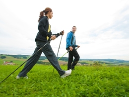
Gunzingerrunde


- Suitable for families
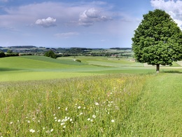
- Flatly
Interactive elevation profile
Create PDF
Tour-Details
Path number: B
Starting place: 4923 Lohnsburg am Kobernaußerwald
Destination: 4923 Lohnsburg am Kobernaußerwald
duration: 2h 32m
length: 10,0 km
Altitude difference (uphill): 59m
Altitude difference (downhill): 102m
Lowest point: 467m
Highest point: 529m
difficulty: easy
condition: easy
panoramic view: Individual Views
Paths covering:
Hiking trail
powered by TOURDATA
The route initially runs the same as A round. From Lauterbach to Gunzing, then along the Waldzeller brook to Magetsham, following the Römerradweg cycle path past the sewage treatment plant and on the footpath and cycle path via Kramling to Lohnsburg am Kobernaußerwald.
- Suitable for groups
- Suitable for seniors
- Suitable for single travelers
- Suitable for friends
- Suitable for couples
- Suitable for children
- Spring
- Summer
- Autumn
- Early winter
Please get in touch for more information.
4923 Lohnsburg am Kobernaußerwald
Phone +43 7754 4110
E-Mail gemeinde@lohnsburg.at
Web www.lohnsburg.at
http://www.lohnsburg.at
You can also visit us on
Visit us on Facebook")
")
")
Interactive elevation profile
Create PDF
Tour-Details
Path number: B
Starting place: 4923 Lohnsburg am Kobernaußerwald
Destination: 4923 Lohnsburg am Kobernaußerwald
duration: 2h 32m
length: 10,0 km
Altitude difference (uphill): 59m
Altitude difference (downhill): 102m
Lowest point: 467m
Highest point: 529m
difficulty: easy
condition: easy
panoramic view: Individual Views
Paths covering:
Hiking trail
powered by TOURDATA