

Sparkasse Ried-Haag Runde
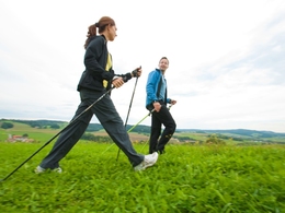


- Suitable for families
- culturally interesting
- Flatly
Interactive elevation profile
Create PDF
Tour-Details
Path number: Nr. 2
Starting place: 4925 Pramet
Destination: 4925 Pramet
duration: 4h 14m
length: 14,8 km
Altitude difference (uphill): 309m
Altitude difference (downhill): 315m
Lowest point: 508m
Highest point: 712m
difficulty: medium
condition: medium
panoramic view: Some Views
Paths covering:
Hiking trail
powered by TOURDATA
We start in the village center and head towards Frankenburg am Hausruck for the approx. 15 km long Sparkasse Ried-Haag round.
After a slight incline, we turn left off the main road and hike on the road in the direction of Hausruck forest through the villages of Kleinpiesenham, Schwandt, Hartlhof, Guggenberg and Feitzing, where we treat ourselves to a little refreshment at the inn z'Feitzing and enjoy the landscape in peace.
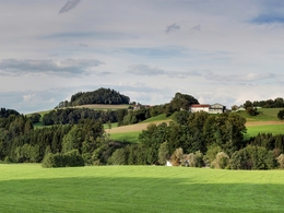
From there we continue into the Hausruck forest, where we hike quietly on a well-maintained forest path on the municipal border with Frankenburg am Hausruck until we turn left in the direction of Bierweg raod. When we leave the forest, a beautiful view of the Prameter bathing lake awaits us and from there we pass the lake. You walk along the culture path for a while until you turn right onto the "Schatzdorferweg" road and from there you walk via Noxberg through Großpiesenham back to the village center.
After a slight incline, we turn left off the main road and hike on the road in the direction of Hausruck forest through the villages of Kleinpiesenham, Schwandt, Hartlhof, Guggenberg and Feitzing, where we treat ourselves to a little refreshment at the inn z'Feitzing and enjoy the landscape in peace.
From there we continue into the Hausruck forest, where we hike quietly on a well-maintained forest path on the municipal border with Frankenburg am Hausruck until we turn left in the direction of Bierweg raod. When we leave the forest, a beautiful view of the Prameter bathing lake awaits us and from there we pass the lake. You walk along the culture path for a while until you turn right onto the "Schatzdorferweg" road and from there you walk via Noxberg through Großpiesenham back to the village center.
- Suitable for groups
- Suitable for single travelers
- Suitable for friends
- Suitable for couples
- Spring
- Summer
- Autumn
- Early winter
Please get in touch for more information.
4925 Pramet
Phone +43 7754 8450
E-Mail gemeinde@pramet.ooe.gv.at
Web www.pramet.at/system/web/default.as…
https://www.pramet.at/system/web/default.aspx?sprache=1
You can also visit us on
Visit us on Facebook")
")
")
")

Interactive elevation profile
Create PDF
Tour-Details
Path number: Nr. 2
Starting place: 4925 Pramet
Destination: 4925 Pramet
duration: 4h 14m
length: 14,8 km
Altitude difference (uphill): 309m
Altitude difference (downhill): 315m
Lowest point: 508m
Highest point: 712m
difficulty: medium
condition: medium
panoramic view: Some Views
Paths covering:
Hiking trail
powered by TOURDATA