Runde REITH
Path number: Nr. 3
Starting place: 4924 Waldzell
Destination: 4924 Waldzell

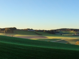
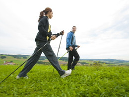
Explore Waldzell and the surrounding area on foot
Hofbauer – Schildorner road – sports farm – horse riding court – Reith – Katzenbach – parking curling place
Bankerl bei der Waldzeller Ache 6
Bankerl bei der Waldzeller Ache 7
Bankerl bei der Waldzeller Ache 7
Bankerl beim Spielplatz
Bankerl beim Sportbauernhof
Bankerl Katzenstatue

Bankerl nachn Franz in Burgstall
Bankerl vorm Pfarrerwald

Hofbaun Bankerl
- Suitable for groups
- Suitable for schools
- Suitable for teenagers
- Suitable for seniors
- Suitable for single travelers
- Suitable for families
- Suitable for friends
- Suitable for couples
- Suitable for children
- Spring
- Summer
- Autumn
- Early winter
Please get in touch for more information.
4924 Waldzell
Phone +43 7754 2255 - 0
E-Mail gemeinde@waldzell.ooe.gv.at
Web www.waldzell.ooe.gv.at
http://www.waldzell.ooe.gv.at
You can also visit us on
Facebook


