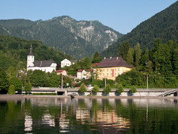
© Photo: Oberösterreich Tourismus GmbH./Robert Maybach: Enjoy the view in Upper Austria
Enjoy the view in Upper Austria
search
Search
Close

Soleleitungsweg-Runde 3

 Interactive elevation profile

Download GPS data
Create PDF

Tour-Details

Starting place: 4802 Ebensee
Destination: 4802 Ebensee

duration: 5h 45m
length: 20,2 km
Altitude difference (uphill): 406m
Altitude difference (downhill): 407m

Lowest point: 426m
Highest point: 504m
difficulty: easy
condition: easy
panoramic view: Individual Views

Paths covering:
Asphalt, Gravel, Hiking trail, Other

powered by TOURDATA

Mostly flat, easy hike along the oldest pipeline in the world, the brine pipeline from Hallstatt to Ebensee, which has been delivering brine from the salt mine to the salt works since 1607.

Starting point: Rathausplatz, where there is a sketch of the route on a roll. Past the Heimathaus, the former seat of the "Salzverweser", - below the parish church - bridge over the Langbathbach - left the pedestrian zone (Marktgasse) - to the crossroads after the leather shop, then right straight ahead - along the edge of the forest on the Soleweg to the Langwies district.

Travelling by public transport
Route planner for independent travellers
Most economical season
  • Spring
  • Summer
  • Autumn
  • Early winter

Please get in touch for more information.


Soleleitungsweg-Runde 3
Tourismusbüro Ebensee
Hauptstraße 34
4802 Ebensee

Phone +43 6133 8016
E-Mail ebensee@traunsee-almtal.at
Web www.ebensee.com
http://www.ebensee.com

We speak the following languages

German

 Interactive elevation profile

Download GPS data
Create PDF

Tour-Details

Starting place: 4802 Ebensee
Destination: 4802 Ebensee

duration: 5h 45m
length: 20,2 km
Altitude difference (uphill): 406m
Altitude difference (downhill): 407m

Lowest point: 426m
Highest point: 504m
difficulty: easy
condition: easy
panoramic view: Individual Views

Paths covering:
Asphalt, Gravel, Hiking trail, Other

powered by TOURDATA