Josefweg - 1. Etappe
Starting place: 4813 Altmünster
Destination: 4852 Weyregg am Attersee
Marktstraße 6
4813 Altmünster
4813 Altmünster

The Josefweg is a spiritual circular route from Lake Traunsee to Lake Atttersee and back in 3 daily stages. The 1st day's stage leads from Altmünster am Traunsee to Weyregg am Attersee.
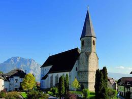
We start at the Altmünster parish church, whose left side altar is adorned with an altarpiece of St. Joseph next to the rococo pulpit (the interesting and beautiful church, which is dedicated to St. Benedict, is described separately) and walk along Marktstrasse, past the municipal office for approx. 400 m in the direction of Gmundnerberg, then turn left into Bahnhofstrasse.
After 100 metres on the right, we follow Stücklbachstrasse, then the Stücklbachweg begins directly alongside the stream.
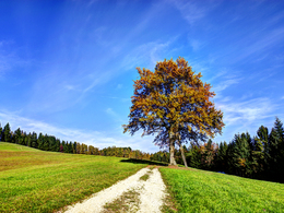
Initially, we pass under the railway bridge and walk past the torrent embankment on a cosy path next to the babbling Stücklbach stream in the forest.
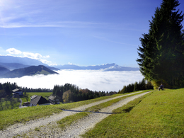
After approx. 500 metres, the path joins the 'Panoramastrasse' (=Staudachstrasse) on the Grasberg with wonderful views of the Traunsee and, on the hill, also of the Tote Gebirge and Höllengebirge mountains.
The signposts take us along small roads and paths (In der Point, Schützenleitenweg) down to Reindlmühl. (Walking time 1 ½ to 2 hours)
The church, built in 1956, is dedicated to St Joseph, who is depicted as a carpenter next to Jesus on the altar wall in the choir.
Continue for approx. 600 metres towards Pinsdorf on the country road, turning left in the right-hand bend towards Wessenaurach. In Kasten we leave the road and turn right to begin the partly steep ascent to Hongar (400 metres altitude). We reach Gasthaus Schwarz and are rewarded with a marvellous view to the north into the Alpine foothills and south into the mountains. (Walking time again approx. 2 hours)
A large cross has been erected next to the inn, where many mountain masses are held.
Now we continue along the ridge - over the Alpenberg (at 973 m the highest point on day 1) to the west, after 1 hour we reach the Kreuzingalm for a coffee break or the first overnight stay. Now we can continue along the road to the Gahberg or hike 400 metres back to the ridge and continue over the Taubenkogel.
From the Gahberg, where the little church once again invites us to take a break, we walk down the Brandsteig to Weyregg with marvellous views of Lake Attersee. Despite contradictory signposting, we only need 1 hour from the Gahberg via the Brandsteig to Weyregg.
We reach the lake directly at the Landeroith inn and are rewarded with delicious fish on the lake terrace and, depending on the season, can take a refreshing dip in the crystal-clear, turquoise lake.
Total walking time approx. 7 h, 23 km
Accessibility / arrival
We recommend travelling by public transport:
By train:
On the Salzkammergutbahn to Altmünster station.
From Altmünster station it is a 1.4 km walk to the starting point at Altmünster parish church.
Or by Salzkammergut Shuttle Service to Altmünster school centre. From here it is only a few steps to the parish church. Call +43 50 422 422 at least one hour before departure and order.
If you are travelling by car, there is a car park on the main road at the info point directly on the B 145.
- Suitable for groups
- Suitable for teenagers
- Suitable for seniors
- Suitable for single travelers
- Suitable for friends
- Suitable for couples
- Spring
- Summer
- Autumn
Please get in touch for more information.
Marktstraße 6
4813 Altmünster
Phone +43 7612 87181
Fax machine +43 7612 87181 - 45
E-Mail info@traunsee-almtal.at
Web www.josefweg-salzkammergut.at
Web traunsee.salzkammergut.at/orte-am-t…
http://www.josefweg-salzkammergut.at
https://traunsee.salzkammergut.at/orte-am-traunsee/altmuenster.html
https://traunsee.salzkammergut.at/orte-am-traunsee/altmuenster.html


