Steinbeisser Tour (exhausting mountainbiketour)
Starting place: 4853 Steinbach am Attersee
Destination: 4853 Steinbach am Attersee
Steinbach Nr. 5
4853 Steinbach am Attersee
4853 Steinbach am Attersee

Starting altitude: 482 m | Highest point: 944 m | Lowest point: 482 m | Elevation gain: 1,100 m | Total distance: 57.4 km | Riding time: 6.07 hours
- Start at the Bierschmiede car park/sports hall in Seefeld.
- Follow the main road towards Steinbach for approx. 1.5km.
- Turn left onto the Großalmstraße towards Altmünster.
- After approx. After approx. 9.6km follow the forest road that branches off to the right and leads to the Langbathsee lakes.
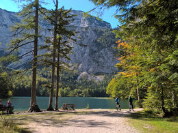
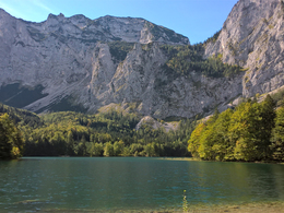
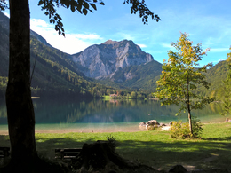
- Circle the Hinterer Langbathsee lake and follow the route towards Vorderer Langbathsee lake. This is reached after 2.3 kilometres. The trail leads past the hunting lodge and along the shore of Vorderer Langbathsee. At the end of the lake you come to a junction. Turn right, cross the Kaltenbach and follow Langbathstraße, which eventually leads into Bledistraße. Follow the route against the backdrop of the northern slopes of the Höllengebirge mountains. On the left, the Langbathbach stream babbles over small artificial cascades and provides welcome cooling.
- Follow the Langbathsee district road towards Ebensee, where you will also pass the valley station of the Feuerkogel cable car.
- Turn left onto the Salzkammergut federal road B145 towards Traunkirchen. Since the construction of three road tunnels through the Sonnstein, a long section of the old lakeside road has been reserved for bikers and walkers, allowing them to enjoy the ride along the steep banks of Lake Traunsee.
- Follow the main road for 6.3km. Then turn left towards Neunkirchen/Mühlbach, into the village of Mitterndorf. Continue straight on through the railway subway. The road bends to the right, follow this road. Then follow the L1298 for approx. 850 metres.
- The road then splits - follow the main road towards Neukirchen/Mühlbach.
- Follow the road, cross the Moosbach and follow the Buchbergstraße towards Steinbach am Attersee at the junction. After around 3.6km, the road joins the Großalm Landesstraße/Viechtau, where you turn left.
- After around 7km, during which you pass the Nadasdy Klause, among other things, a small forest path leads off the Großalmstraße to the right, which you turn onto. The forest path rejoins the Großalmstraße, which you follow for a further 3.5km.
- At Gasthof Kienklause, turn right onto Kientalstraße. Follow this road to the starting point in Seefeld.
- Start Finish: Hotel Föttinger, Bierschmiede or Restaurant at the lido
- On the route: Gasthaus Kienklause, inn at the front Langbathsee, Jausenstation am Taferlklaussee.
- Rundweg around both Langbathsee lakes
- Vorderer Langbathsee
With the support of the UASC Attersee
Starting place: 4853 Steinbach am Attersee
Destination: 4853 Steinbach am Attersee
duration: 6h 4m
length: 57,4 km
Altitude difference (uphill): 1.082m
Altitude difference (downhill): 1.080m
difficulty: medium
condition: medium
panoramic view: Great panorama
Paths covering:
Asphalt, Gravel, Street, Other
Starting point: Start parking lot Kientalstrasse in Seefeld
Destination: Start parking lot Kientalstrasse in Seefeld
further information:
- Flatly
- Board possible
details mountainbike
- Riding technique: medium
Spring till autumn
Accessibility / arrival
Start the tour in Seefeld am Attersee | The parking lot is located at the beginning of Kientalstrasse.
- Parking space: 5
- Suitable for groups
- Suitable for teenagers
- Suitable for friends
- Suitable for couples
- Spring
- Summer
- Autumn
Please get in touch for more information.
Steinbach Nr. 5
4853 Steinbach am Attersee
Phone +43 7666 7719 - 60
E-Mail info.steinbach@attersee.at
Web www.asc-attersee.at
Web attersee-attergau.salzkammergut.at
http://www.asc-attersee.at
https://attersee-attergau.salzkammergut.at
https://attersee-attergau.salzkammergut.at
You can also visit us on
Facebook YouTube Wikipedia


