© Photo: Oberösterreich Tourismus GmbH./Robert Maybach: Enjoy the view in Upper Austria
Enjoy the view in Upper Austria
search
Search
Close

Bad Hall Rennrad Tour Nationalpark Kalkalpen

 Interactive elevation profile

Download GPS data
Create PDF

Tour-Details

Starting place: 4540 Bad Hall
Destination: 4540 Bad Hall

duration: 6h 0m
length: 152,0 km
Altitude difference (uphill): 1.999m
Altitude difference (downhill): 1.987m

difficulty: difficult
condition: difficult
panoramic view: Great panorama

Paths covering:
Asphalt, Gravel, Street

powered by TOURDATA

On the sunny side to Molln to the northern border of the national park (Ramsau), on the southern side (Windischgarsten) loop via Edelbach (Panorama) to Spital, via Vorderstoder (Panorama) and Kremstal back.

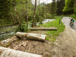
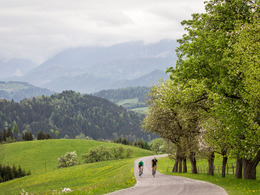
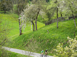
The royal stage begins comfortably: via the Steyrtal "sunny side" to the Molln National Park Centre. After the alpine loop into Ramsau, the Klauser reservoir beckons. The route is then relatively flat along the foot of the Sengsengebirge mountains through forests and villages to the southern border of the national park, to the picturesque village of Windischgarsten. Shortly before Rosenau, the scenically stunning and physically demanding loop over the foothills of the Haller Mauern to Spital am Pyhrn begins - Pyhrgas and Co. look down while you marvel and sweat. On the no less magnificent detour into the Stodertal valley across the meadows and through the forests of Roßleithen and Hinterstoder, Warschenek, Großer Priel and the remaining limestone walls of the Totes Gebirge seem close enough to touch. From Vorderstoder onwards, the route runs alongside the lively babbling Loigisbach stream on its own, because it goes downhill. With these marvellous images in your head, the 10 km on the B138 to Micheldorf are quickly forgiven, especially as they provide further nice views of the Klauser reservoir. The route home then continues along Kremstal roads with little traffic as far as Wartberg and over a final small section of terrain to Bad Hall.


Travelling by public transport
Route planner for independent travellers
  • Suitable for single travelers
  • Suitable for friends
  • Suitable for couples
Most economical season
  • Spring
  • Summer
  • Autumn

Please get in touch for more information.


Bad Hall Rennrad Tour Nationalpark Kalkalpen
Tourismusverband Bad Hall
4540 Bad Hall

Phone +43 7258 7200 - 0
E-Mail info@badhall.at
Web www.badhall.at
https://www.badhall.at

We speak the following languages

German

 Interactive elevation profile

Download GPS data
Create PDF

Tour-Details

Starting place: 4540 Bad Hall
Destination: 4540 Bad Hall

duration: 6h 0m
length: 152,0 km
Altitude difference (uphill): 1.999m
Altitude difference (downhill): 1.987m

difficulty: difficult
condition: difficult
panoramic view: Great panorama

Paths covering:
Asphalt, Gravel, Street

powered by TOURDATA