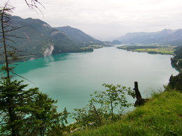
© Photo: Oberösterreich Tourismus GmbH./Robert Maybach: Enjoy the view in Upper Austria
Enjoy the view in Upper Austria
Search
Search
Close

Gamswand Mountain Route

  • Flatly

 Interactive elevation profile

Download GPS data
Create PDF

Tour-Details

Path number: 21
Starting place: 5340 St. Gilgen
Destination: 5340 St. Gilgen

duration: 1h 30m
length: 10,0 km
Altitude difference (uphill): 250m
Altitude difference (downhill): 250m

Lowest point: 539m
Highest point: 826m
difficulty: medium
condition: medium
panoramic view: Great panorama

Paths covering:
Asphalt, Gravel, Hiking trail

powered by TOURDATA

A varied run with a lengthy mountainous section.

Start and finish at the Fischerwirt Schiffsstation (jetty) – lake path towards Abersee  - Ferienhof Lueg  - Franzosenschanze  (area) – across the main road – right uphill on Forststraße to Gamswandalm – right along the mountain ridge (beautiful view) – Gasthaus Weißwand  (guesthouse) – ski slope towards Laim – pass Laimer ski lift on the left hand side towards Fuschl/Mozartsteig – Annenquelle – right downhill towards Laim – Laimerfeld – Hochreithstraße (road) – left downhill to the main road and cross over – Schwarzenbrunnerstraße (road) – Mozartplatz (square) – right past the town hall and church and straight ahead back to the starting point.
Starting point: Ship berth St. Gilgen
Destination: Ship berth St. Gilgen

further information:
  • Flatly

Accessibility / arrival

Directly in the center St. Gilgen, near the jetty.

Parking
  • Parking space: 20
Travelling by public transport
Route planner for independent travellers
  • Free entry
  • Suitable for groups
  • Suitable for kids (10 - 14 Year)
  • Suitable for single travelers
  • Suitable for friends
  • Suitable for couples
Most economical season
  • Spring
  • Summer
  • Autumn

Please get in touch for more information.


Gamswand Mountain Route
Wolfgangsee Tourismus Gesellschaft
Au 140
5360 St. Wolfgang im Salzkammergut

Phone +43 6138 8003
E-Mail info@wolfgangsee.at
Web wolfgangsee.salzkammergut.at/
https://wolfgangsee.salzkammergut.at/

We speak the following languages

German
English

 Interactive elevation profile

Download GPS data
Create PDF

Tour-Details

Path number: 21
Starting place: 5340 St. Gilgen
Destination: 5340 St. Gilgen

duration: 1h 30m
length: 10,0 km
Altitude difference (uphill): 250m
Altitude difference (downhill): 250m

Lowest point: 539m
Highest point: 826m
difficulty: medium
condition: medium
panoramic view: Great panorama

Paths covering:
Asphalt, Gravel, Hiking trail

powered by TOURDATA