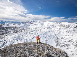
© Foto Oberösterreich Tourismus GmbH/Robert Maybach: Schneeschuwandern im Mühlviertel in der Nähe von Bad Zell.
Search
Search
Close

Rossarsch ski tour (tour area Hintersteineralm)

 Interactive elevation profile

Download GPS data
Create PDF

Tour-Details

Starting place: 4582 Spital am Pyhrn
Destination: 4582 Spital am Pyhrn

duration: 5h 26m
length: 8,6 km
Altitude difference (uphill): 1.298m
Altitude difference (downhill): 70m

Lowest point: 934m
Highest point: 2.172m
difficulty: medium
condition: medium
panoramic view: Some Views

Paths covering:
snow

powered by TOURDATA

The ski tour to the Rossarsch is very scenic and suitable for beginners, however, be noted is the length of the tour! From the car park go back to the rear Steiner pastures. Past the houses and follow the forest road to the valley. Now go over the brook and at the first Abzwiegung right and the road up to the end at about 1,280 m follow.

Now go along the back Steinerbach valley. After about 1.5 km, at about 1,400 meters, turn left up through the sparse forest and flatter terrain always something keeping left towards Iron Bergl to the hunting lodge Postal (1,666 m).

Here you will encounter the winter mark "Wurzeralm-Liezener Lodge No. 218." This, however, as well as the Iron Bergl leave left. Now keep to the right and slightly uphill it goes to the south side of the Ross ass. Now go on the sunny back in a couple of bends up to the summit of Ross ass.
Starting point: There are a maximum of 50 parking spaces available at the car park at the former road maintenance depot on the Pyhrnpass! Parking fee: car with 1 occupant = 8,-/day Car with 2 passengers = 6,-/day Car from 3 and more occupants = 4,-/day Other parking options: Wurzeralm cable car car park (tourist fee is to be paid at the cash desk), car park at the Pyhrnpass pass summit or at the Lexgraben (state border with Styria).
Destination: There are a maximum of 50 parking spaces available at the car park at the former road maintenance depot on the Pyhrnpass! Parking fee: car with 1 occupant = 8,-/day Car with 2 passengers = 6,-/day Car from 3 and more occupants = 4,-/day Other parking options: Wurzeralm cable car car park (tourist fee is to be paid at the cash desk), car park at the Pyhrnpass pass summit or at the Lexgraben (state border with Styria).

Details - Ski
  • Descent: difficulty: medium, 1244 Metres of altitude
Accessibility / arrival

Coming from Spital am Pyhrn, drive onto the Pyhrnpass (B138).
The parking lot at the former road maintenance depot on the Pyhrnpass offers a maximum of 50 parking spaces (for a fee)!

Other parking options: Wurzeralm cable car car park (tour operator fee is to be paid at the cash desk), car park on the Pyhrnpass pass summit or at Lexgraben (border with Styria).


Parking fees

A maximum of 50 parking spaces are available at the parking lot at the former road maintenance depot on the Pyhrn Pass (for a fee)!

Travelling by public transport
Route planner for independent travellers
General price information

A maximum of 50 parking spaces are available at the parking lot at the former road maintenance depot on the Pyhrnpass!


Parking rate: car with 1 occupant = 8.00 / day


Car with 2 occupants = 6.00 / day


Cars from 3 and more passengers = 4, - / day

Payment methods
Other payment methods
Cash payment
  • Suitable for seniors
  • Suitable for single travelers
  • Suitable for friends
  • Suitable for couples
Most economical season
  • Early winter
  • Deep winter

Please get in touch for more information.


Rossarsch ski tour (tour area Hintersteineralm)
Pyhrn-Priel Tourismus GmbH
Stiftsplatz 1
4582 Spital am Pyhrn

Phone +43 7563 249
Fax machine +43 7563 249 - 20
E-Mail spital@pyhrn-priel.net
Web www.urlaubsregion-pyhrn-priel.at
http://www.urlaubsregion-pyhrn-priel.at

We speak the following languages

German

 Interactive elevation profile

Download GPS data
Create PDF

Tour-Details

Starting place: 4582 Spital am Pyhrn
Destination: 4582 Spital am Pyhrn

duration: 5h 26m
length: 8,6 km
Altitude difference (uphill): 1.298m
Altitude difference (downhill): 70m

Lowest point: 934m
Highest point: 2.172m
difficulty: medium
condition: medium
panoramic view: Some Views

Paths covering:
snow

powered by TOURDATA