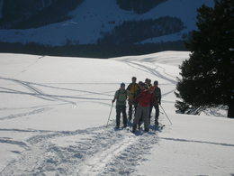
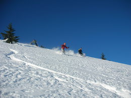
Skitour up to Windkogel or Thorhöhe
Starting place: 5350 Strobl
Destination: 5350 Strobl

Ascent:
From the Berggasthaus Thoralm (Inn), 40 minutes.
Over the open south facing slope to a flat saddle and either left to the Windkogel summit or right to the top of the Thorhöhe.
From the Information kiosk in Gschwendt, 3 ½ hours.
A narrow road leads to the Vitz am Berg farmhouse; from there go upwards along the Niedergadenalm road (several possible short cuts) up to the Schwarzeneckalm pastures and continue in a southeasterly direction to the Niedergadenalm pastures.
Here, continue southwards and climb over meadowland passing the Höplihütte hut to the Windkogel summit (right) or to the Thorhöhe (left).
Descents:
A) To the Thoralm plateau. A short and easy descent via open meadowland from both summits over the unobstructed south slopes down to the Thoralm plateau.
B) Via the Schwarzeneckalm plateau to Gschwendt, an easy and popular descent. From the top of the Thorhöhe or the Windkogel respectively, a nice run descends northwards to the Höplihütte hut from which the numerous huts on the Niedergadenalm plateau can be reached by way of a steep run. Take the mountain road (which begins here) in a northwesterly direction to the Schwarzeneckalm plateau and then continue on a little further going under the power lines on a nice run to the “Vitz am Berg” farmhouse, from where you can get down to the Information kiosk on the B 158 by way of a narrow road.
Parking
- Parking space: 5
Most economical season
- Early winter
- Deep winter
Please get in touch for more information.
5350 Strobl
Phone +43 6137 7255
E-Mail office@wolfgangsee.at
Web wolfgangsee.salzkammergut.at
https://wolfgangsee.salzkammergut.at


