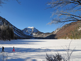
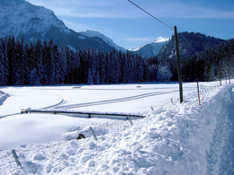
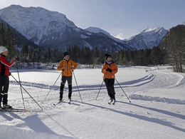
Cross country slope Langbathsee
Starting place: 4802 Ebensee
Destination: 4802 Ebensee


Not in operation
Wonderfully scenic trail along the two Langbath lakes
To the LOIPEN REPORT
There are 2 entrances: one directly on the shore of the Vord. See (total length 8 km) and one approx. 2 km before the Vord. Langbathsee at the inn "Zur Kreh" (total length 13 km). There is a skating track from the Vorderer Langbathsee to the "Krehwiese" and then on the right-hand side at the "Jagerbachl" back to the starting point (6 km). There is also a groomed loop for beginners in the so-called Krehwiese.
Refreshments are available at the Langbathseestüberl (+43 6133-40181, opening times depending on the weather).
Parking
- Parking space: 150
- Parking area for disabled: 2
- Bus parking space: 2
General price information
Using the slope is free
Most economical season
- Deep winter
Please get in touch for more information.
")
4802 Ebensee
Phone +43 6133 8016
Fax machine +43 6133 8016 - 870
E-Mail ebensee@traunsee-almtal.at
Web www.ebensee.com
Web www.traunsee-almtal.at/ebensee
http://www.ebensee.com
http://www.traunsee-almtal.at/ebensee
http://www.traunsee-almtal.at/ebensee