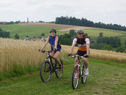
Mountainbikestrecke "Kocher-Runde"
Starting place: 4084 St. Agatha
Destination: 4084 St. Agatha
information: Akutmeldung/Information
The medium-difficulty Kocher loop is 22.3 kilometres long with a somewhat more difficult section.
In St. Agatha, head east along the Minichweg past the beautiful Fadingerhof farm to Götzling. A steep descent leads down to Sägeweck and a steep climb back up to Bäckerhof and Sonnleiten (only for experienced cyclists - an easy variant is signposted). The route continues via Holzwühr to the chapel in Hölzing, left on the gravel path to Hausleiten and the Reiter snack station in Dittersdorf. A steep descent takes you down to Scheiblberg, through the Mühlgraben past the hammer mill (visit) and the village of Gschwendt to the Jagawirt in Riesching, from where you return to St. Agatha via gravel paths. Cafe Haider and Gasthaus Ozlberger invite you to stop for a bite to eat. Most economical season
- Spring
- Summer
- Autumn
Please get in touch for more information.
Spattenbrunn
4084 St. Agatha
Phone +43 7278 20337
mobile +43 664 5032224
E-Mail leader@hausrucknord.at
Web www.sternenland.at
http://www.sternenland.at


