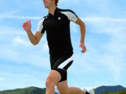
© Photo: Oberösterreich Tourismus GmbH./Robert Maybach: Enjoy the view in Upper Austria
Enjoy the view in Upper Austria
search
Search
Close

Runnersfun Runde Scharnstein by Runnersfun

  • Suitable for families
  • Flatly

 Interactive elevation profile

Download GPS data
Create PDF

Tour-Details

Starting place: 4644 Scharnstein
Destination: 4644 Scharnstein

duration: 0h 48m
length: 3,1 km
Altitude difference (uphill): 29m
Altitude difference (downhill): 29m

Lowest point: 498m
Highest point: 530m
difficulty: easy
condition: easy
panoramic view: No view

Paths covering:
Asphalt

powered by TOURDATA

The short green Runnersfun lap is perfect for beginners and those with a tight time budget.
Starts at the church square on asphalt, then through the untouched lock forest, over the Lärchweg and the Brauhofstraße, past Scharnstein Castle, where the crime museum and the reptile zoo are located. On asphalt back to the start board at the church square. Also ideal for everyone who "finally wants to do something!"

The sponsorship for this round was taken over by Runnersfun!

www.runnersfun.com
Accessibility / arrival

How to get to the Almtal (to Scharnstein im Almtal):

We recommend that you travel by public transport!

by train: from Wels train station with the Almtalbahn (line 153) in the direction of Grünau im Almtal to the Scharnstein-Mühldorf stop; Return also with the Almtalbahn to Wels.
Numerous connections from Wels station to the main trains on the western line (line 101)
by bus: OÖVV bus line 533 Gmunden - Scharntein - Grünau im Almtal; Get off at the center of Scharnstein

with the Traunstein Taxi Route 52 from Laakirchen to the Scharnstein Ortsmitte stop, or from Vorchdorf with the Traunstein Taxi Route 70, please call the taxi headquarters at least 1 hour in advance on the telephone number 050-422 1691 or order on the otaxi app.

by car:
West motorway A1: Vienna - Voralpenkreuz-A9 or
Inntal motorway A8 Passau - Wels - Voralpenkreuz A9 -
continue via the exit Ried / Tr. - Voitsdorf - Pettenbach - Scharnstein
West motorway A1: Munich - Salzburg - Regau - Gmunden - Scharnstein

Connection to public transport / timetable information:

Parking
  • Parking space: 50
Travelling by public transport
Route planner for independent travellers
  • Suitable for groups
  • Suitable for schools
Most economical season
  • Spring
  • Summer
  • Autumn

Please get in touch for more information.


Runnersfun Runde Scharnstein by Runnersfun
Runnersfun Consulting GmbH Bewegung erleben
Krottenseestraße 45
4810 Gmunden

Phone +43 7612 20822
E-Mail office@runnersfun.com
Web www.runnersfun.com/
http://www.runnersfun.com/

We speak the following languages

German

 Interactive elevation profile

Download GPS data
Create PDF

Tour-Details

Starting place: 4644 Scharnstein
Destination: 4644 Scharnstein

duration: 0h 48m
length: 3,1 km
Altitude difference (uphill): 29m
Altitude difference (downhill): 29m

Lowest point: 498m
Highest point: 530m
difficulty: easy
condition: easy
panoramic view: No view

Paths covering:
Asphalt

powered by TOURDATA