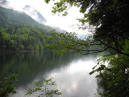
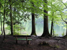
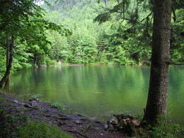
© Photo: Oberösterreich Tourismus GmbH./Robert Maybach: Enjoy the view in Upper Austria
Enjoy the view in Upper Austria
search
Search
Close

Nussensee Round Walk (Ruine Wildenstein - Nussensee)

  • pets allowed
  • Suitable for families
  • Flatly

 Interactive elevation profile

Download GPS data
Create PDF

Tour-Details

Path number: 11
Starting place: 4820 Bad Ischl
Destination: 4820 Bad Ischl

duration: 4h 18m
length: 15,5 km
Altitude difference (uphill): 265m
Altitude difference (downhill): 264m

Lowest point: 465m
Highest point: 655m
difficulty: medium
condition: medium
panoramic view: Some Views

Paths covering:
Asphalt, Gravel

powered by TOURDATA

Distance: 15.5 km
Walking time: 4 hours 45 minutes
Difference in altitude: ascent and descent 300 m
Trail conditions: part asphalt, part gravel, forest paths, few steps
From the starting point, walk through the Pfarrgasse and along the Esplanade. Follow the River Traun to a natural monument the Kaltenbachteich by a new road bridge (previously the crossing place of the local railway line). Before the wooden chapel keep to the right and go by Kaltenbachau to Katrinseilbahn (cable car). Walk a few metres up the ski slope, then leave it just above a tall building on the left and walk in a big curve to the rear of the building. Follow this path up to a forest track near the ruins of Wildenstein. After a visit to the former seat of the imperial curator, take the forest track to the right through the woods and sprawling meadows (at junctions always watch the yellow signs) through a thickening wood to Nussensee. After a short descent the path branches sharply around the lake in front of the lake to the left. At this point it is possible to go staight on and reduce the walk by 30 minutes. The main trail follows round the lake, then take the gravel road by the outflow stream. On arriving at the first houses go slightly downhill, through the village to the main road (bus stop). From here walk along the river Ischl to Pfandl (Bus stop). At the traffic lights, cross the main road, cross the River Ischl on the main road bridge and use the riverside path on the right side of the river back to the centre of Bad Ischl.

Travelling by public transport
Route planner for independent travellers
  • Suitable for groups
  • Suitable for schools
  • Pets allowed
Most economical season
  • Spring
  • Summer
  • Autumn

Please get in touch for more information.


Nussensee Round Walk (Ruine Wildenstein - Nussensee)
Tourismusverband Bad Ischl
4820 Bad Ischl

Phone +43 6132 27757
E-Mail office@badischl.at
Web www.badischl.at
http://www.badischl.at

We speak the following languages

German

 Interactive elevation profile

Download GPS data
Create PDF

Tour-Details

Path number: 11
Starting place: 4820 Bad Ischl
Destination: 4820 Bad Ischl

duration: 4h 18m
length: 15,5 km
Altitude difference (uphill): 265m
Altitude difference (downhill): 264m

Lowest point: 465m
Highest point: 655m
difficulty: medium
condition: medium
panoramic view: Some Views

Paths covering:
Asphalt, Gravel

powered by TOURDATA