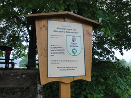
Round Walk to Sterzens Abendsitz
Path number: 6
Starting place: 4820 Bad Ischl
Destination: 4820 Bad Ischl
Distance: 3.2 km
Walking time: 1 hour
Difference in altitude: ascent and descent 60 m
Road surface: asphalt, some gravel, some steps
Follow further on, descending to the Nöbauerweg and left to Kroissengraben after a short descent this becomes a gravel road through the forest. The road ascends and descends through the forest back to the River Traun. From here follow Maxquellgasse downstream to the Maxquellbrunnen (Maximilian fountain). This was erected in 1868 by Emperor Franz Joseph to commemorate the shooting of his brother, Emperor Maximilian of Mexico, in Queretaro in 1867 .The fountain also serves as a Kneipp Health system. The trail leads under the railway line and over the Steinfeld Bridge back to the starting point.
Path number: 6
Starting place: 4820 Bad Ischl
Destination: 4820 Bad Ischl
duration: 0h 49m
length: 3,2 km
Altitude difference (uphill): 31m
Altitude difference (downhill): 34m
Lowest point: 463m
Highest point: 497m
difficulty: easy
condition: easy
panoramic view: Some Views
Paths covering:
Asphalt, Gravel, Hiking trail
Starting point: Bad Ischl Tourist board (Trinkhalle) Auböckplatz 5, 4820 Bad Ischl
Destination: Bad Ischl Tourist board (Trinkhalle) Auböckplatz 5, 4820 Bad Ischl
further information:
- Flatly
- Suitable for groups
- Suitable for schools
- Pets allowed
- Suitable for families
- Spring
- Summer
- Autumn
- Early winter
Please get in touch for more information.
4820 Bad Ischl
Phone +43 6132 27757
E-Mail office@badischl.at
Web www.badischl.at
http://www.badischl.at


