© Photo: Oberösterreich Tourismus GmbH./Robert Maybach: Enjoy the view in Upper Austria
Enjoy the view in Upper Austria
Search
Search
Close

To Ebensee and Lake Traun (Soleweg)

  • pets allowed
  • Suitable for families
  • culturally interesting

 Interactive elevation profile

Download GPS data
Create PDF

Tour-Details

Path number: 4
Starting place: 4820 Bad Ischl
Destination: 4802 Ebensee

duration: 5h 0m
length: 19,0 km
Altitude difference (uphill): 84m
Altitude difference (downhill): 100m

Lowest point: 447m
Highest point: 513m
difficulty: easy
condition: easy
panoramic view: Individual Views

Paths covering:
Asphalt, Gravel

powered by TOURDATA

Distance: 19 km (9.3 km to railway station at Langwies)
Walking time: 5 hours (2 hours 30 minutes to station at Langweis)
Difference in altitude: 70 m ascent , descent 100 m
Trail Condition: Asphalt and gravel paths, meadows and forest paths,
The last kilometres are usually closed in winter due to avalanche danger.
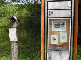
In this long hike along the River Traun the route follows the Soleweg (route of the old Salt Pipeline) from Langweis to Ebensee. From the starting point go towards the railway station, with the station to the right follow the road and cross the Steinfeldstraße bridge over the River Traun. Follow the road, keeping left until reaching ÖBF information board before Rettenbach. At the intersection take the path left along the River Traun towards Roith. At Roith,by another information board,cross the rail bridge over the River Traun. Do not use the route through the Cement Works. Take the path next to the main road, following the river downstream for 2km,to the Traunbridge in Mitterweißenbach (bus stop) .Cross this bridge and take the,initially wide road, past Mitterweißenbach station. This road narrows and is little used. At the railway crossing and a group of houses called Kößlbach (here the yellow signs end) follow straight on along the gravel road through the forest to Langweis station. Here again cross the River Traun (bus stop)and take the asphalted walking and biking trail 300m to the right, until reaching a small bridge (Langbach), cross the main road and 70 m further on is the beginning of the Soleweg (Information Board) This climbs at first then becomes a two metre wide,flat trail. It is then 9 km straight into the centre of Ebensee (train station). Note: There are gates and at houses always go straight on. At one point the path follows the old Langweis road for 300m.

Starting point: Trinkhalle
Destination: City center

further information:

Details - hiking
  • themed path
Travelling by public transport
Route planner for independent travellers
  • Suitable for groups
  • Suitable for schools
  • Pets allowed
Most economical season
  • Spring
  • Summer
  • Autumn

Please get in touch for more information.


To Ebensee and Lake Traun (Soleweg)
Tourismusverband Bad Ischl
4820 Bad Ischl

Phone +43 6132 27757
E-Mail office@badischl.at
Web www.badischl.at
http://www.badischl.at

We speak the following languages

German

 Interactive elevation profile

Download GPS data
Create PDF

Tour-Details

Path number: 4
Starting place: 4820 Bad Ischl
Destination: 4802 Ebensee

duration: 5h 0m
length: 19,0 km
Altitude difference (uphill): 84m
Altitude difference (downhill): 100m

Lowest point: 447m
Highest point: 513m
difficulty: easy
condition: easy
panoramic view: Individual Views

Paths covering:
Asphalt, Gravel

powered by TOURDATA