Höll: Wurzeralm - Höll - Schwarzlacke and back
Path number: 201a
Starting place: 4582 Spital am Pyhrn
Destination: 4582 Spital am Pyhrn
Stiftsplatz 1
4582 Spital am Pyhrn
4582 Spital am Pyhrn

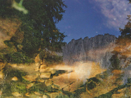
The "hell" is a rockfall area and lies at an elevation of about 1,300 m between the steep walls of the Stubwieswipfels and Schwarzecks. Observant hikers will find ancient petroglyphs on large boulders.
1957 carvings have been found in some rock fall blocks in 1958 was a first scientific commission instead. Altogether there are in the valley 13 Rocks, only some are accessible and are on the way. On the Durchkriechstein are the "Man in Tower" and the "stylized family" particularly important rock carvings to be seen. The "hell" is one of the most important rock art occurrences of Austria.From the top station of the funicular Wurzeralm hike through the alpine village past the Friends of Nature House to Teichlschwind where the road branches off to the right 201. The trail now leads slightly downhill to a Crevice, the "Rolling Luag" and through the woods and rocky terrain down into a valley. There you will find at Route the various rock carvings to visit. Passing the "Durchkriechstein" you come to a small karst spring of the so-called "Schwarzlacke".
From the "Schwarzlacke" you have to then turn around and walk back towards Wurzeralm mountain station.
Path number: 201a
Starting place: 4582 Spital am Pyhrn
Destination: 4582 Spital am Pyhrn
duration: 1h 27m
length: 4,0 km
Altitude difference (uphill): 215m
Altitude difference (downhill): 215m
Lowest point: 1.266m
Highest point: 1.414m
difficulty: easy
condition: easy
panoramic view: Individual Views
Paths covering:
Hiking trail
Starting point: Wurzeralm Standseilbahn Bergstation
Destination: Wurzeralm Standseilbahn Bergstation
further information:
Details - hiking
- themed path
Accessibility / arrival
With the Wurzeralm funicular in Spital am Pyhrn will take you directly to the starting point.
- Suitable for groups
- Suitable for schools
- Suitable for families
- Spring
- Summer
- Autumn
Please get in touch for more information.
Stiftsplatz 1
4582 Spital am Pyhrn
Phone +43 7563 249
Fax machine +43 7563 249 - 20
E-Mail spital@pyhrn-priel.net
Web www.urlaubsregion-pyhrn-priel.at
https://www.urlaubsregion-pyhrn-priel.at


