© Photo: Oberösterreich Tourismus GmbH./Robert Maybach: Enjoy the view in Upper Austria
Enjoy the view in Upper Austria
search
Search
Close

Stamering - Buchholz-Runde

  • Flatly

 Interactive elevation profile

Download GPS data
Create PDF

Tour-Details

Path number: H9
Starting place: 4175 Herzogsdorf
Destination: 4175 Herzogsdorf

duration: 1h 56m
length: 6,5 km
Altitude difference (uphill): 172m
Altitude difference (downhill): 171m

Lowest point: 570m
Highest point: 719m
difficulty: easy
condition: medium
panoramic view: Some Views

Paths covering:
Asphalt, Hiking trail

powered by TOURDATA

information: Akutmeldung/Information
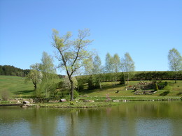
Turn left in front of the fire station. A meadow path takes us to the Burgstallerhof inn (snack station with impressive pond). From Stamering, we walk along a meadow path, the former Hansberg country road, before we reach the higher Fölsen settlement via a climb. After a section on a goods road, we head back down to Neußerling via the Großberg.
Travelling by public transport
Route planner for independent travellers
Most economical season
  • Spring
  • Summer
  • Autumn

Please get in touch for more information.


Stamering - Buchholz-Runde
Marktgemeinde Herzogsdorf
Kirchenplatz 10
4175 Herzogsdorf

Phone +43 7231 2255
Fax machine +43 7231 2255 - 40
E-Mail gemeinde@herzogsdorf.ooe.gv.at
Web www.herzogsdorf.at
http://www.herzogsdorf.at

We speak the following languages

German

 Interactive elevation profile

Download GPS data
Create PDF

Tour-Details

Path number: H9
Starting place: 4175 Herzogsdorf
Destination: 4175 Herzogsdorf

duration: 1h 56m
length: 6,5 km
Altitude difference (uphill): 172m
Altitude difference (downhill): 171m

Lowest point: 570m
Highest point: 719m
difficulty: easy
condition: medium
panoramic view: Some Views

Paths covering:
Asphalt, Hiking trail

powered by TOURDATA