Kinderweg Herzogsdorf
Path number: H6
Starting place: 4175 Herzogsdorf
Destination: 4175 Herzogsdorf
Kirchenplatz 10
4175 Herzogsdorf
4175 Herzogsdorf

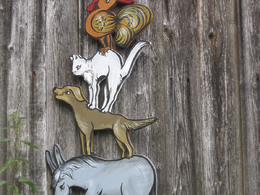
The children's trail initiated by the Herzogsdorf library comprises several stations (15 - 20) on various fairy tales and stories. Accompanying the trail, quiz cards are laid out at the Gahleitner inn, which is the starting and finishing point. Every child receives a small gift when they hand in their completed quiz slip at the Gahleitner inn.
The children's trail runs around the village centre.
The children's trail runs around the village centre.
Path number: H6
Starting place: 4175 Herzogsdorf
Destination: 4175 Herzogsdorf
duration: 0h 34m
length: 2,4 km
Altitude difference (uphill): 5m
Altitude difference (downhill): 5m
Lowest point: 567m
Highest point: 588m
difficulty: easy
condition: easy
panoramic view: Individual Views
Paths covering:
Asphalt, Gravel, Hiking trail
further information:
- Flatly
- Board possible
Details - hiking
- themed path
Parking
- Parking space: 35
- Suitable for groups
- Suitable for schools
- Suitable for kids (0 - 14 Year)
- Suitable for kids (all ages)
- Suitable for single travelers
- Suitable for families
- Suitable for friends
- Suitable for couples
- Suitable for children
- Spring
- Summer
- Autumn
Please get in touch for more information.
Kirchenplatz 10
4175 Herzogsdorf
Phone +43 7231 2255
Fax machine +43 7231 2255 - 40
E-Mail gemeinde@herzogsdorf.ooe.gv.at
Web www.herzogsdorf.at
http://www.herzogsdorf.at


