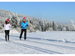
Naarntal Loipe
Starting place: 4282 Pierbach
Destination: 4282 Pierbach
Not in operation
My cross-country skiing paradise!
The romantic, multi-faceted landscape of the AktivWelt Freiwald with its high plateaus at an altitude of 500 - 1000 m above sea level forms the atmospheric backdrop for a cross-country skiing excursion away from the hustle and bustle of classic winter sports centres.The AktivWelt Freiwald's network of over 280 kilometres of double-tracked trails is family-friendly. Panoramic views and atmospheric forests present themselves to runners, while cosy inns invite you to linger. For all sporty skiers, there are of course separate, selective skating trails and floodlights make it possible to enjoy a leisurely run on the trails in the evening. A voluntary donation is requested for the use of the trails.
Information about the current cross-country ski trail situation can be obtained from the Mühlviertler Alm Tourist Office, telephone: +43 (0)7956/7304.
Starting place: 4282 Pierbach
Destination: 4282 Pierbach
duration: 0h 30m
length: 7,0 km
Altitude difference (uphill): 84m
Altitude difference (downhill): 87m
Lowest point: 482m
Highest point: 508m
difficulty: easy
condition: easy
panoramic view: No view
Paths covering:
snow
Starting point: Knife mill, Steinbruck mill or Tober mill
Details - Trail
- Type of Nordic skiing run: Classic style
Accessibility / arrival
by car:
from Linz - continue on the Mühlkreis motorway A7- B124 Königswiesener Straße - Pierbach
Most economical season
- Deep winter
Please get in touch for more information.
other information
- Toilet facility for disabled people
Unterweißenbach 19
4282 Pierbach
Phone +43 7956 7304
Fax machine +43 7956 7304 - 4
E-Mail office@muehlviertleralm.at
Web www.muehlviertleralm.at
http://www.muehlviertleralm.at


