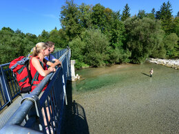
© Photo: Oberösterreich Tourismus GmbH./Robert Maybach: Enjoy the view in Upper Austria
Enjoy the view in Upper Austria
search
Search
Close

From the water to the cider - hiking trail

  • pets allowed
  • Suitable for pushchairs
  • culinary interesting
  • culturally interesting
  • Flatly
  • Possible accommodation

 Interactive elevation profile

Download GPS data
Create PDF

Tour-Details

Path number: 11
Starting place: 4654 Bad Wimsbach-Neydharting
Destination: 4654 Bad Wimsbach-Neydharting

duration: 2h 45m
length: 10,7 km
Altitude difference (uphill): 86m
Altitude difference (downhill): 82m

Lowest point: 350m
Highest point: 423m
difficulty: easy
condition: medium
panoramic view: Dreamtour

Paths covering:
Asphalt, Hiking trail

powered by TOURDATA

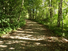
A circular route on forest, meadows and road, which is partially signposted as a running or Nordic walking route.

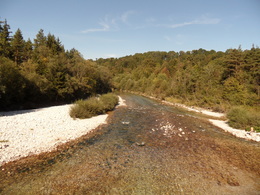
From the market square, head towards Almegg (Steinerkirchen) to the "Almbrücke" bridge, then right along the "Alm" river (nature reserve!) To the "Penninger Steg" (running mile) bridge. From there it continues to the "Pettenbacher Landesstraße" street (detour to the mouth of the Laudach only 3 minutes). The bridge over the "Laudach" creek must be crossed. The inn "Gasthof Watschinger" invites you to rest. After a hearty refreshment, continue to the garage "Autohaus Müller", on the right the forest path to the stop "Blankenberg" (Train), over the Leit’n past the “Tuffquelle” natural monument. From there, the circular route leads along the dirt road Kößlwangerstraße - Wegkreuz - towards the village of Aigen, where a beautiful view of the Dead Mountains is offered. Follow the signs to the organic farmer "Saalachhof" (Family Ennser - a cozy stop for most thirsty people) on "Saalachstraße" street towards Bad Wimsbach to the sports and shoe center "Hochleithner". To the left of the shop is the inn "Mostschank Huemer" (Fri-Sun from 4:00 p.m.) or straight back to the starting point, the market square, where, in addition to the refreshments (Café Konditorei Jöchtl, Wirtshaus Staudinger or Bakery Bachinger), there is also a cultural interest. The parish church of St. Stephanus, the natural monument "Kastanienallee" or the museum "Hackenschmiede" can be visited.
Accessibility / arrival

Accessibility / arrival How to get to the Almtal (to Bad Wimsbach-Neydharting):

We recommend that you travel by public transport!


by train: Get off in Bad Wimsbach-Neydharting with the local train from Lambach to Vorchdorf (line 160, Stern & Hafferl). It is only a few minutes' walk from the train station to the market square. There is also a public bus stop on the market square.

by bus: OÖVV bus line 504 Wels - Bad Wimsbach-Neydharting - Roitham
Bus train information

by the Traunstein Taxi Route 80 from Almspitz via Bad Wimsbach-Neydharting - Vorchdorf station to Hagenmühle. Call at least 1 hour in advance on the telephone number 050-422 1691 at the taxi center or order on the otaxi app.

by car:
Coming from the Autobahn (A1), take the Vorchdorf exit in the direction of Bad Wimsbach-Neydharting. After about 6.5 kilometers you will reach the beautiful market square.

Parking
  • Parking space: 20
  • Parking area for disabled: 1
  • Bus parking space: 1
Shuttle service

Traunstein Taxi Route 80 from Almspitz via Bad Wimsbach-Neydharting - Vorchdorf station to Hagenmühle.

Call at least 1 hour in advance on the telephone number 050-422 1691 at the taxi center or order on the otaxi app.

Travelling by public transport
Route planner for independent travellers
  • Suitable for groups
  • Suitable for schools
  • Suitable for pushchairs
  • Pets allowed
  • Suitable for seniors
  • Suitable for couples
Most economical season
  • Summer

Please get in touch for more information.

other information
  • Toilet facility for disabled people

From the water to the cider - hiking trail
Tourismusverband Traunsee-Almtal
4654 Bad Wimsbach-Neydharting

Phone +43 7245 25055 - 0
mobile +43 7616 8268
E-Mail almtal@traunsee-almtal.at
Web www.bad-wimsbach.at
Web www.traunsee-almtal.at
http://www.bad-wimsbach.at
https://www.traunsee-almtal.at

You can also visit us on

Visit us on Facebook

We speak the following languages

German
English

 Interactive elevation profile

Download GPS data
Create PDF

Tour-Details

Path number: 11
Starting place: 4654 Bad Wimsbach-Neydharting
Destination: 4654 Bad Wimsbach-Neydharting

duration: 2h 45m
length: 10,7 km
Altitude difference (uphill): 86m
Altitude difference (downhill): 82m

Lowest point: 350m
Highest point: 423m
difficulty: easy
condition: medium
panoramic view: Dreamtour

Paths covering:
Asphalt, Hiking trail

powered by TOURDATA