Schönberg in Ebensee
Starting place: 4802 Ebensee
Destination: 4802 Ebensee
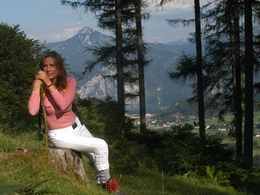
The view to the fantastic alpine panorama as well as the beautiful alpine flora are the reasons for the popularity of the Schönberg as a destination for hikers.
Hiking-time:
parking lot - Hochkogelhaus: approximately 3 hours
Hochkogelhaus - valley Feuertal- Schönberg- Hochkogelhaus: approximately 4 hours
Starting place: 4802 Ebensee
Destination: 4802 Ebensee
duration: 6h 22m
length: 8,1 km
Altitude difference (uphill): 1.489m
Altitude difference (downhill): 350m
Lowest point: 535m
Highest point: 2.024m
difficulty: difficult
condition: difficult
panoramic view: Great panorama
Paths covering:
Hiking trail
Starting point: parking lot "Schwarzenbach"
Destination: Schönberg
Accessibility / arrival
from the highway: departure Regau-B145 in the direction of Bad Ischl-departure Offensee-till parking lot "Schwarzenbach"
Most economical season
- Summer
Please get in touch for more information.
4802 Ebensee
Phone +43 6133 8016
E-Mail ebensee@traunsee.at
Web www.ebensee.at
http://www.ebensee.at


