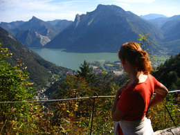
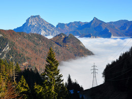
© Photo: Oberösterreich Tourismus GmbH./Robert Maybach: Enjoy the view in Upper Austria
Enjoy the view in Upper Austria
Search
Search
Close

Feuerkogelaufstieg von Ebensee

 Interactive elevation profile

Download GPS data
Create PDF

Tour-Details

Starting place: 4802 Ebensee
Destination: 4802 Ebensee

duration: 3h 30m
length: 5,5 km
Altitude difference (uphill): 1.127m
Altitude difference (downhill): 77m

Lowest point: 475m
Highest point: 1.585m
difficulty: medium
condition: medium
panoramic view: Great panorama

Paths covering:
Hiking trail

powered by TOURDATA

The Feuerkogel offers not only for inexperienced hikers the opportunity to enjoy a great view, even experienced climbers can have a great hike.

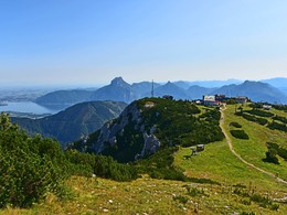
From the parking area of the cable car Feuerkogelseilbahn leads the signposted path across the Schulerberg to the legendary Katzenwoferlklause. There branches the compound growth to the Edelweiß-Europe-Path on the right side off. On the crest of the hill Wimmersberg going, you can see the settlement of Ebensee. The path, which is secured in some places with ropes, wrenches to the right and intersects the steep northern flank of the mountain Wimmersberg. At a flattening out you cross for the first time the ski-slope. Via uphill serpentines you reach a detent, which is called "verfallene Gsollstube". At the Feuerkogel you continue through a forest, until you reach the alignment of the ski-slope, which leads in the Gsoll. Passing the "Sag", the "Bucheggerkurve" and the "Eselrast", you reach the first mountain inn - the Kranabeth hut - and the plateau of the Feuerkogel.

Hiking-time: Valley station Feuerkogel - mountain station cable car: approximately 3 hours

Starting point: Parking area of the cable car station "Feuerkogel"
Destination: Feuerkogel plateau

Accessibility / arrival

departure Regau-B 145 in the direction of Bad Ischl-turn right into the center of Ebensee-in front of the bridge turn right to the parking lot of the cable car "Feuerkogel"

E-service station / recharging station
  • Charging point for electric cars (fees apply)
  • Charging point for e-bikes (free of charge)
Travelling by public transport
Route planner for independent travellers
Payment methods
Debit and credit cards
American Express
ATM card
Mastercard
Visa
Other payment methods
Cash payment
Most economical season
  • Spring
  • Summer
  • Autumn

Please get in touch for more information.


Feuerkogelaufstieg von Ebensee
Tourismusbüro Ebensee
Hauptstraße 34
4802 Ebensee

Phone +43 6133 8016
E-Mail ebensee@traunsee-almtal.at
Web www.ebensee.com
Web www.traunsee-almtal.at/ebensee
http://www.ebensee.com
http://www.traunsee-almtal.at/ebensee
We speak the following languages

German

 Interactive elevation profile

Download GPS data
Create PDF

Tour-Details

Starting place: 4802 Ebensee
Destination: 4802 Ebensee

duration: 3h 30m
length: 5,5 km
Altitude difference (uphill): 1.127m
Altitude difference (downhill): 77m

Lowest point: 475m
Highest point: 1.585m
difficulty: medium
condition: medium
panoramic view: Great panorama

Paths covering:
Hiking trail

powered by TOURDATA