© Photo: Oberösterreich Tourismus GmbH./Robert Maybach: Enjoy the view in Upper Austria
Enjoy the view in Upper Austria
Search
Search
Close

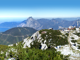
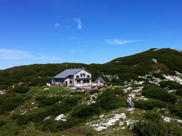
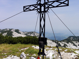
Hut "Rieder Hütte" - big "Höllkogel" up on Höllengebirge at Ebensee

 Interactive elevation profile

Download GPS data
Create PDF

Tour-Details

Path number: 820, 804, Teilabschnitt E4, 830 und 833, Wanderspass Tour Nr. 6
Starting place: 4802 Ebensee
Destination: 4802 Ebensee

duration: 2h 58m
length: 6,9 km
Altitude difference (uphill): 546m
Altitude difference (downhill): 275m

Lowest point: 1.526m
Highest point: 1.797m
difficulty: medium
condition: medium
panoramic view: Some Views

Paths covering:
Hiking trail

powered by TOURDATA

With or without Höllkogel, that is the question.


The tour starts at the top station of the cable car Feuerkogelseilbahn. Past mountain inns, traversing the eastern flank of the Heumahdgupfes, you come to the path 820 in the rear Edltal. In serpentines gets a short ascent overcomed. After passing a safe, secured by ropes constriction, the trail passes through typical Dolinengassen and then to a fork. Keep right and reach the hut Rieder Hütte, which is situated in a hollow. From the protection cottage you reach the big Höllkogel in half an hour. The way back leads through the Höllkogelgrube via the described route to the Feuerkogel.

Hiking-time:
Bergstation - hut Rieder Hütte: approximately 2 hours
hut Rieder Hütte - big Höllkogel: approximately 1/2 hour
Starting point: mountain station of the cable car "Feuerkogel"
Destination: big Höllkogel

Travelling by public transport
Route planner for independent travellers
Most economical season
  • Spring
  • Summer
  • Autumn

Please get in touch for more information.


Hut "Rieder Hütte" - big "Höllkogel" up on Höllengebirge at Ebensee
Tourismusverband Traunsee-Almtal, Tourismusbüro Ebensee
4802 Ebensee

Phone +43 6133 8016
E-Mail ebensee@traunsee-almtal.at
Web www.ebensee.com
Web www.ebensee.at
http://www.ebensee.com
http://www.ebensee.at

We speak the following languages

German

 Interactive elevation profile

Download GPS data
Create PDF

Tour-Details

Path number: 820, 804, Teilabschnitt E4, 830 und 833, Wanderspass Tour Nr. 6
Starting place: 4802 Ebensee
Destination: 4802 Ebensee

duration: 2h 58m
length: 6,9 km
Altitude difference (uphill): 546m
Altitude difference (downhill): 275m

Lowest point: 1.526m
Highest point: 1.797m
difficulty: medium
condition: medium
panoramic view: Some Views

Paths covering:
Hiking trail

powered by TOURDATA