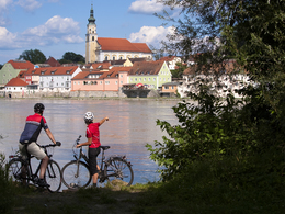
Von Schärding nach Passau
Starting place: 4780 Schärding
Destination: 94036 Passau
The cities of Schärding and Passau are traditionally linked through their close neighbourhood and shared history on the River Inn.
The baroque town in Upper Austria and the city on three rivers in Bavaria are also linked by the Inn Cycle Path. From the baroque ambience of Schärding, the route leads northwards, past Wernstein and through green meadows to Passau.Route: You leave Schärding via the Old Inn Bridge and turn right onto the Inn Cycle Path on the Bavarian side immediately after the former customs house, where you reach Neuburg am Inn via Vornbach. Here you cross the Inn over the Marienbrücke bridge to Wernstein am Inn. Continue along the Inn Cycle Path R3 past the Ingling power station to the three-river city of Passau. Passau Cathedral with the largest cathedral organ in the world is particularly worth seeing.
Payment methods
Cash payment
- Suitable for seniors
- Suitable for single travelers
- Suitable for families
- Suitable for friends
- Suitable for couples
- Spring
- Summer
- Autumn
Please get in touch for more information.
Freistädterstr. 119
4780 Schärding
Phone +43 732 221022
Fax machine +43 732 7277 - 701
E-Mail info@oberoesterreich.at
Web www.oberoesterreich.at/aktivitaeten…
https://www.oberoesterreich.at/aktivitaeten/sommer/radfahren/landesradwege.html


