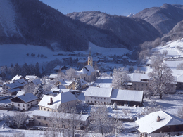
Steyrling - Brunnental valley cross-country trail
Starting place: 4571 Klaus an der Pyhrnbahn
Destination: 4571 Klaus an der Pyhrnbahn
Not in operation
The Brunnental valley cross-country trail is a Ski-Doo trail in a stunning scenic setting!
Starting place: 4571 Klaus an der Pyhrnbahn
Destination: 4571 Klaus an der Pyhrnbahn
duration: 2h 37m
length: 8,0 km
Altitude difference (uphill): 319m
Altitude difference (downhill): 319m
Lowest point: 523m
Highest point: 646m
difficulty: easy
condition: easy
panoramic view: Great panorama
Paths covering:
snow
Starting point: Centre of Steyrling near the Steyrlingerhof guest house
Destination: Centre of Steyrling near the Steyrlingerhof guest house
further information:
- Flatly
Details - Trail
- Nordic skiing facilities: Marked Nordic skiing run
- Type of Nordic skiing run: Classic style
- free
Always open when snow conditions are good!
Accessibility / arrival
Centre of Steyrling near the Steyrlingerhof guest house.
General price information
There is no charge for using the trail!
- Free entry
Most economical season
- Deep winter
Please get in touch for more information.
Bahnhofstraße 2
4571 Klaus an der Pyhrnbahn
Phone +43 7562 5266
Fax machine +43 7562 5266 - 10
E-Mail info@pyhrn-priel.net
Web www.urlaubsregion-pyhrn-priel.at
https://www.urlaubsregion-pyhrn-priel.at
powered by TOURDATA


