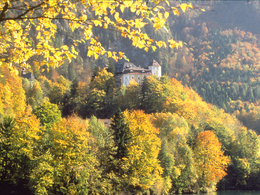
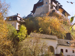
Castle Klaus – Parish Curch – Hofwiese (Court Meadow)
Starting place: 4564 Klaus an der Pyhrnbahn
Destination: 4564 Klaus an der Pyhrnbahn
Kniewas 17
4564 Klaus an der Pyhrnbahn
4564 Klaus an der Pyhrnbahn

From the castle a path leads to the so called Hofwiese (court meadow) and back again to the main road.
From the southern end of the village of Klaus (direction Windischgarsten) walk along the main road B138 to the tavern "Taverne zur Maut". Here the road forks leading uphills past the castle, then past the early baroque mountain church.The church was built in 1618 and is known due to traditional Music Summer of Klaus. Since 1962 the “Candlelight Concerts” take place at the church on Saturdays throughout the summer months of July and August.
You can either continue directly to Klaus along the main road or continue your hike along the Circular Hiking Trail Klauser Reservoir in in a southerly direction. From the parking area below the mountain church you will reach the reservoir along a forest path with beautiful views before heading back to Klaus along the main road.
Walking Time: 15 min.
Trail Nr: 4
Starting place: 4564 Klaus an der Pyhrnbahn
Destination: 4564 Klaus an der Pyhrnbahn
duration: 0h 36m
length: 1,7 km
Altitude difference (uphill): 85m
Altitude difference (downhill): 81m
Lowest point: 453m
Highest point: 527m
difficulty: easy
condition: very easy
panoramic view: Some Views
Paths covering:
Asphalt, Hiking trail
Starting point: Southern edge of town by the Taverne zur Maut in Klaus an der Pyhrnbahn
Destination: Southern edge of town by the Taverne zur Maut in Klaus an der Pyhrnbahn
further information:
- Flatly
Accessibility / arrival
by car:
From Vienna: West motorway direction Salzburg - A1 junction Voralpenkreuz - A9 exit Klaus
From Munich: A8 Salzburg - West motorway A1 towards Linz - turn Voralpenkreuz - A9, exit Klaus
From Berlin: A9 Bayreuth - Nuremberg - A3 Regensburg - Passau - A8 to Konoten Voralpenkreuz - A9, exit Klaus
by train:
Vienna - Linz - Klaus at the Pyhrnbahn;
Munich - Salzburg - Linz - Klaus at the Pyhrnbahn;
Hamburg - Passau - Linz - Klaus at the Pyhrnbahn;
Frankfurt - Passau - Linz - Klaus at the Pyhrnbahn;
Berlin - Nürnberg - Passau - Linz - Hinterstoder;
- Suitable for pushchairs
- Spring
- Summer
- Autumn
Please get in touch for more information.
Kniewas 17
4564 Klaus an der Pyhrnbahn
Phone +43 7565 31333
E-Mail klaus@pyhrn-priel.net
Web www.urlaubsregion-pyhrn-priel.at
https://www.urlaubsregion-pyhrn-priel.at


