© Photo: Oberösterreich Tourismus GmbH./Robert Maybach: Enjoy the view in Upper Austria


Kleine Grenzlandtour


- culinary interesting
- culturally interesting
- Flatly
Interactive elevation profile
Create PDF
Tour-Details
Starting place: 4240 Waldburg
Destination: 4240 Waldburg
duration: 3h 32m
length: 43,6 km
Altitude difference (uphill): 812m
Altitude difference (downhill): 805m
Lowest point: 550m
Highest point: 802m
difficulty: medium
condition: medium
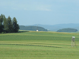
panoramic view: Great panorama
Paths covering:
Asphalt
powered by TOURDATA
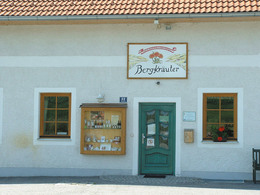
Start at the UaB farm Desl (altitude 700 m)
Sights along the bridleway: Sights along the bridleway: 3 late Gothic winged altars in Waldburg, mountain herb hall, windmills in Schenkenfelden, Hinterkönigschlag peasant war memorial, Grasslmühle mill, state border, Lorenzmühle mill, Heidenstein, original horse-drawn railway line, PEB viaduct near Rainbach, St. Peter's church.
Starting point: Desl´s little Farm
Destination: Desl´s little Farm
further information:
- culinary interesting
- Flatly
- Board possible
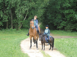
Details riding
- Area: medium
- Good riding experience: easy
Accessibility / arrival
by car:
From Linz continue on the Mühlkreisautobahn towards Prague (40 km)
From the Czech border towards Linz (15 km)
by train:
From Linz with the Summerauerbahn to Freistadt station
(3 km outside the center)
Linz station - Freistadt
Most economical season
- Spring
- Summer
- Autumn
Please get in touch for more information.
Marreith 23
4240 Freistadt
Phone +43 7956 7304
E-Mail office@reit-erlebnis-akademie.at
Web www.reit-erlebnis-akademie.at
Web www.muehlviertel.at
http://www.reit-erlebnis-akademie.at
http://www.muehlviertel.at
http://www.muehlviertel.at
Interactive elevation profile
Create PDF
Tour-Details
Starting place: 4240 Waldburg
Destination: 4240 Waldburg
duration: 3h 32m
length: 43,6 km
Altitude difference (uphill): 812m
Altitude difference (downhill): 805m
Lowest point: 550m
Highest point: 802m
difficulty: medium
condition: medium
panoramic view: Great panorama
Paths covering:
Asphalt
powered by TOURDATA